Landmannalaugar is a geothermal area in the Fjallabak Nature Reserve, in the highlands of South Iceland. It stands at the edge of the Laugahraun lava field, formed by an eruption around 1477. The area is known for its natural hot springs, which are open to the public for bathing, and for the rhyolite mountains around them. It marks the northern end of the Laugavegur hiking trail, where the Iceland Touring Association runs a mountain hut and a campsite. Only F-roads lead in, so a 4x4 is needed.
Landmannalaugar Geothermal Area
Local name: Landmannalaugar
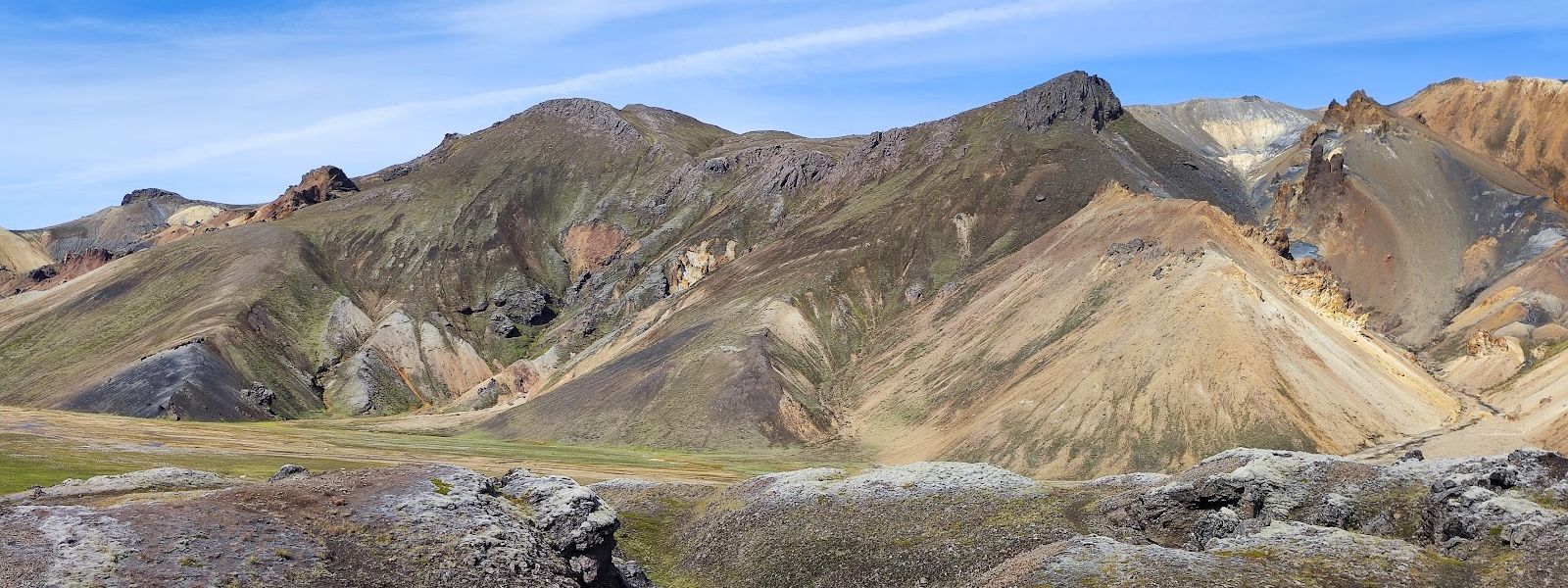
The hot springs rise at the edge of Laugahraun, a lava field left by an eruption around 1477.
- Parking
- Two unpaved car parks, roughly 950 m and 1.4 km from the springs. The farther one is free of charge.
- Difficulty
- Signposted trails, from a few kilometres to all-day treks. About an hour up Bláhnjúkur, an easy loop through the lava field to Brennisteinsalda, four hours to Ljótipollur.
- Transport
- A bus stop named Landmannalaugar lies about 850 m from the springs.
- Advance booking
- A parking reservation has been required since the 2024 season, daily between 8 am and 3 pm in summer. Numbers are limited and reservations are made in advance.
- Address
- Landmannalaugar, 851, Iceland
What makes it special
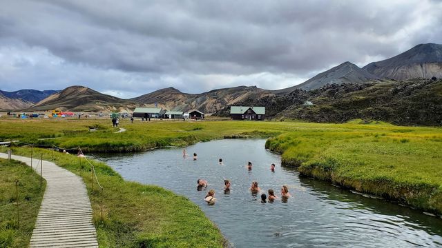
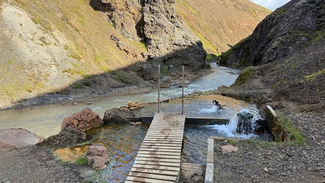
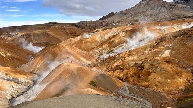
The springs sit at the edge of Laugahraun, a lava field left by an eruption around 1477. Rhyolite mountains in orange, red, yellow and green ring the valley, with dark obsidian ground between them and glaciers in the distance. The geothermal springs are open to the public for bathing; the pool beside the campsite is fed by hot water that mixes with a cold stream running through it.
Landmannalaugar is the northern end of the Laugavegur trail, and the Iceland Touring Association runs a mountain hut here. Shorter walks cover the same ground: about an hour up Bláhnjúkur, an easy loop through the lava field to Brennisteinsalda ("Sulphur Wave"), four hours out to the Ljótipollur crater lake.
Good to know
- 4x4 only: F-roads are the only roads in, so a 4x4 is mandatory. River crossings may be needed depending on the route and the weather.
- Route matters: F208 from the north has no river crossings. The approach from the south involves fording rivers.
- Weather: conditions change within minutes. Come dressed for rain, wind and cold whatever the forecast says.
- Beds and pitches: the Iceland Touring Association hut and a campsite stand beside the springs.
- Signage: the trails are signposted, and information points stand within half a kilometre of the springs.
Getting there
Access is by F-road, and a 4x4 is mandatory. F208 from the north reaches the area without river crossings, while the approach from the south involves fording rivers, so check road conditions before setting out. Cars stop at unpaved car parks short of the site, which leaves a walk of about a kilometre to the springs, the hut and the campsite.
Best time to visit
Better: summer. The hot springs, the mountain hut and the Laugavegur trail all serve the summer season, and horse riding into Jökulgil (Glacier Valley) runs each summer.
Avoid: winter, if walking is the plan. Winter use of the area is cross-country skiing.
Highland weather changes within minutes in any season, so a settled forecast is not a plan.
Sun & daylight
Nearby Places

Similar Places


Landmannalaugar Geothermal Area on the map
The only roads in are F-roads, and the approach from the south requires fording rivers. Drive it in a 4x4 and check road conditions before setting out. Highland weather changes within minutes.
Get directions

Your whole travel map in one place
Get inspired by new places around the world and find the ones worth the journey
Frequently asked questions
Do you need a 4x4 to get to Landmannalaugar?
Yes. Only F-roads lead in, so a 4x4 is mandatory. River crossings may be needed depending on the route and the weather: F208 from the north has none, the approach from the south has rivers to ford.Can you bathe in the hot springs?
Yes. The geothermal springs are open to the public for bathing. The pool near the campsite is fed by hot water that mixes with a cold stream, so the temperature varies across it.Is there anywhere to stay?
The Iceland Touring Association operates a mountain hut for hikers, and there is a campsite beside it. Landmannalaugar is also the first of the huts along the Laugavegur trail.How long are the walks from the site?
Anything from a few kilometres to a full day. Bláhnjúkur takes about an hour to climb, the loop through the Laugahraun lava field to Brennisteinsalda is easy, and Ljótipollur crater lake is a four-hour walk.