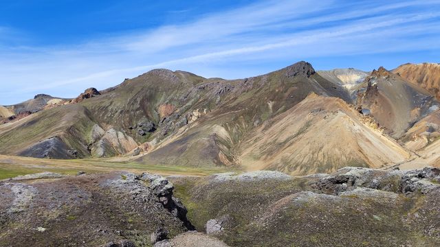
Blahnukur is a volcanic peak in the Icelandic highlands, beside Landmannalaugar in South Iceland. A trail climbs from the valley floor to the summit over loose gravel and volcanic ash, gaining height steadily the whole way. From the top the view takes in glaciers and lava fields on every side. The climb pairs with the neighbouring Brennisteinsalda loop, and the approach on foot crosses the river. This is a hike, not a viewpoint you can drive to.
Blahnukur Volcano
Local name: Bláhnúkur

Hikers have started this climb in rain and reached the summit in snow, in September.
- Accessibility
- Not suitable for wheelchairs or limited mobility: unpaved approach, river crossings on foot, and a steep climb on loose ash.
- Parking
- Unpaved car parks at Landmannalaugar, about 1.5–2 km from the mountain. The farther one is free.
- Difficulty
- Steep, sustained climb on loose gravel and volcanic ash. A trail sign gives 1.3 km to the summit; the switchbacks make it much longer. Unbridged river crossings on the approach. Hiking shoes with grip required.
- Transport
- Nearest stop: Landmannalaugar, about 1.5 km from the mountain.
- Address
- Landmannalaugar (851, Fjallabak)
What makes it special
The climb is the reason to come. The trail runs from the valley floor to the summit over loose gravel and volcanic ash, and it does not let up. A sign at the bottom gives 1.3 km; the switchbacks make the real walk far longer than that. Fitness helps, but grip on your boots helps more.
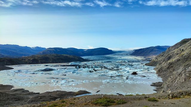
The reward is a full circle of view: glaciers and lava fields, and on a clear day you can see a very long way.
Blahnukur pairs with the Brennisteinsalda loop, and the order matters. Climb Blahnukur first, because the steep inclines are easier going up than coming down. On the loop the route is marked by coloured posts. Note the colour you are following and look for it at junctions.
Good to know
- River crossings: there are no bridges on the approach. The crossings are made on foot, and after rain the river overflows.
- Bring a towel. Your feet get wet at the crossings, and the climb starts straight afterwards.
- Footing: loose gravel and volcanic ash the whole way. Hiking shoes with grip are needed, and the surface is worst on the descent.
- Weather: rain in the valley can be snow at the summit, even in September. Pack for conditions you did not plan for.
- Order of the loop: climb Blahnukur before Brennisteinsalda, because the steep sections are easier going up than down.
Getting there
You cannot drive to the foot of the mountain. Cars and buses stop at Landmannalaugar, and the rest is on foot: a walk out across the valley, then the climb. The approach crosses the river, and there are no bridges, so you wade it. After rain the water runs higher and the crossing takes longer. The trail up begins where the valley ends, and it climbs from the first step.
Best time to visit
Best: a dry, clear day. The whole point of the summit is the view, and the river crossings on the approach are at their easiest when it has not rained.
Avoid: heavy rain and the day after it. The river overflows, there are no bridges, and the crossings are the part of the walk you cannot skip.
Judge the weather at the top, not at the car park. Snow can fall on the summit in September while it is only raining below.
Sun & daylight
Nearby Places
Similar Places


Blahnukur Volcano on the map
The river on the approach is unbridged and rises in rain; the crossings are made on foot. The climb is steep on loose gravel and volcanic ash, which slides underfoot and is hardest on the way down. The summit has its own weather: snow there while rain falls in the valley. Carry gear for conditions you did not set out in.
Get directions

Your whole travel map in one place
Get inspired by new places around the world and find the ones worth the journey
Frequently asked questions
How long does the climb take?
Roughly an hour and a half to the summit at a steady pace. The trail sign at the bottom gives 1.3 km, but the switchbacks make the walk far longer than that figure suggests.Should I climb Blahnukur or Brennisteinsalda first?
Blahnukur first. The steep inclines are easier to climb than to descend, so taking them upwards saves the worst of the loose ground.Are there river crossings on the way?
Yes. There are no bridges, and the crossings are waded on foot. After rain the river overflows and they get harder. Bring a towel.What is the ground like underfoot?
Loose gravel and volcanic ash for the whole climb. Hiking shoes with grip are needed, and the surface is most awkward on the descent.What can you see from the summit?
Glaciers and lava fields in every direction, in a full circle around the peak. On a clear day the view carries a very long way.