Askja is an active volcano in the central highlands of Iceland, in the northeast of the country. The name covers a group of nested calderas inside the Dyngjufjöll mountains, which rise to 1,514 m. The outer caldera takes in about 50 km². Within it lie Öskjuvatn, formed by the eruption of 1875 and the second deepest lake in Iceland at 220 m, and Víti, a small explosion crater with water warm enough to swim in. The caldera floor sits at about 1,100 m. The last eruption was in 1961.
Askja Caldera
Local name: Askja
Apollo astronauts trained on the ash and lava around Askja before flying to the Moon, and the Astronaut Monument in Húsavík names all 32 of them.
- Parking
- Free car park inside the caldera, at the top of the track above Dreki hut.
- Difficulty
- About 2.5 km each way from the car park to Öskjuvatn and Víti, roughly 20 minutes over ash and lava, with one small climb. The descent into Víti is steep.
- Transport
- Guided 4x4 tours to Askja run from Akureyri.
- Hours
- The roads in are usually open only about three to four months, from late June until early October.
- Address
- Askja, 660
What makes it special
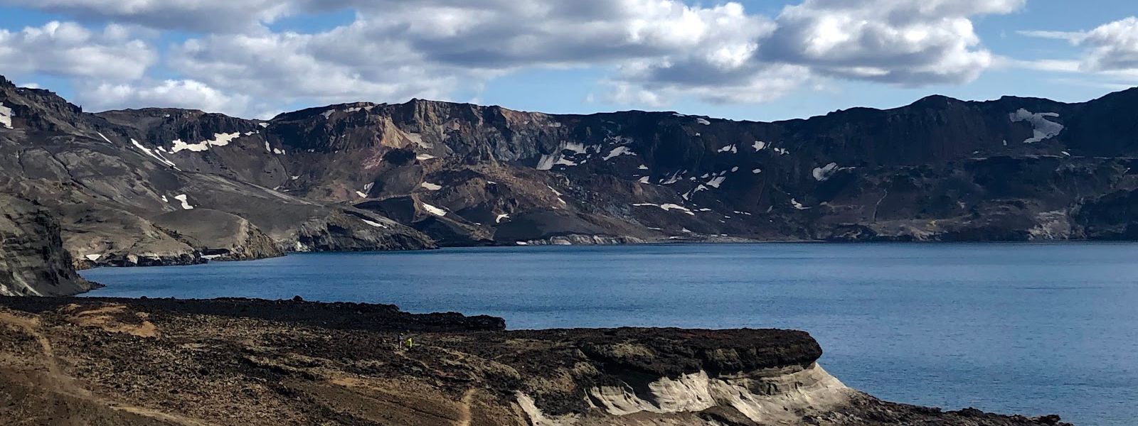
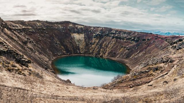
Two lakes sit inside the caldera, and they are nothing alike. Öskjuvatn fills the crater left by the 1875 eruption. It is 220 m deep, the second deepest lake in Iceland, and frozen over most of the year. Víti, beside it, is a small explosion crater holding milky blue water at around 24–26°C. People swim in it at their own risk. The way down is steep and slick even when dry, and the vents on the crater floor are hot. The rim walk between the two gives the wider view: orange-brown ash, black lava and the flat caldera floor at about 1,100 m.
Good to know
- A 4x4 is essential. The approach crosses unbridged rivers; the F905–F910 route has two fords, passable in August after little rain.
- Snow lingers. In early July the road can be blocked short of the car park, leaving about 4 km on foot each way through snow.
- Dreki has beds. Two mountain huts and a campsite stand at Dreki, by Drekagil canyon, the last shelter below the caldera.
- Bring swimwear if you plan to get into Víti. The crater lake is warm, and swimming there is at your own risk.
Getting there
Askja lies about 100 km from the ring road, and all of that is F-road: a 4x4 is the minimum, and there are rivers to ford. Allow three to four hours each way for the drive. The road passes Dreki hut, then climbs a rough, bumpy 8 km into the caldera to the car park. From there the lakes are reached on foot.
Best time to visit
Best: mid-July to early September, once the snow has cleared from the last stretch of road.
Avoid: October to June. The F-roads are closed and there is no way in by car.
Askja sits in the rain shadow of Vatnajökull and gets only about 450 mm of rain a year, so clear days here are common even when the coast is grey.
Sun & daylight
Nearby Places


Similar Places



Featured in our guides
Askja Caldera on the map
The descent into Víti is steep and slippery even when dry, and the vents on the crater floor are hot enough to burn. Swimming in the crater lake is at your own risk. A landslide into Öskjuvatn in July 2014 raised a wave estimated at 30 m, and a slide like it is the likeliest explanation for the two scientists who vanished on the lake in 1907.
Get directions

Your whole travel map in one place
Get inspired by new places around the world and find the ones worth the journey
Frequently asked questions
When did Askja last erupt?
In 1961, between 26 October and 5 December, near the northern rim of the caldera. That eruption produced the Vikrahraun lava flow. The system has erupted at least 175 times in the last 7,200 years. Magma has been accumulating under the caldera since August 2021, with 40 cm of uplift measured by November 2022, and the aviation colour code was raised to yellow.What happened in the 1875 eruption?
A 17-hour subplinian eruption began on 28 March 1875 and was followed the next day by a rhyolitic explosion. Ash more than 1 cm thick covered 5,000 km², and in the Eastfjords it poisoned grazing land and killed livestock. At least 16 farms were abandoned in 1876. Tephra reached Norway, Sweden, Germany and Poland. The Öskjuvatn caldera dates from this eruption.How big is Askja?
The central volcano is 20 km across. The outer caldera covers about 50 km², with later collapses inside it: the main summit caldera about 8 km wide, Kollur about 4 km, and the Öskjuvatn caldera about 5 km. The surrounding Dyngjufjöll mountains rise to 1,514 m.What else is worth seeing on the way?
Drekagil, the canyon of dragons, cuts into the mountains beside Dreki hut. Herðubreið stands within 25 km and Kverkfjöll within 41 km. The Holuhraun lava field, laid down by the 2014–2015 eruption, is on the same highland route and gives a view towards the Vatnajökull glacier.