Catalonia beyond Barcelona: a 7-day road trip itinerary
13 min read23 destinations
Catalonia · Spain
You've done Barcelona. This is what's left: four different Catalonias stacked one after another within a week's drive — the salt mountain and stone villages of Bages, the cliff-top plateau of Collsacabra, the volcanic cones of Garrotxa, and the medieval towns of the Empordà coast. The loop below runs about 600 km over seven days (not counting the detours into Beget or out to the Cap de Creus lighthouse) and stays inside Barcelona and Girona provinces the whole time — no motorway marathons, no returning to Barcelona until the last afternoon.
Contents
- Day 1 — Montserrat and the salt mountain of Cardona
- Day 2 — Rupit, Tavertet and the Collsacabra balconies
- Day 3 — Up to Núria on the rack railway
- Day 4 — Camprodon, Beget and Setcases in the Ter valley
- Day 5 — Down into the volcanoes of Garrotxa
- Day 6 — Empordà castles to the edge of Cap de Creus
- Day 7 — Baix Empordà villages and the coast home
Day 1 — Montserrat and the salt mountain of Cardona
Expect narrow, single-lane roads with passing places into villages like Beget, Tavertet and around Cap de Creus; a standard rental car handles all of it, just not at speed. May–June and September–October are the sweet spot: mountain roads are clear, Costa Brava traffic hasn't peaked, and the Cremallera de Núria rack railway runs its normal timetable. July–August works too — book Costa Brava overnight stays and time Day 6's Cap de Creus visit around the vehicle restriction (details below) further ahead. This route deliberately skips the Lleida Pyrenees (Aigüestortes, Val d'Aran) and the Priorat wine country and Tarragona coast — both make a different week, not an extension of this one.
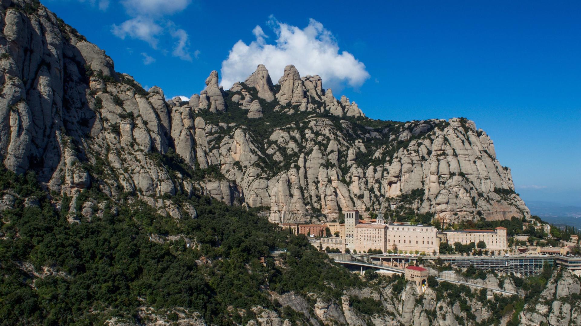
Leave Barcelona early — Montserrat is only 60 km out (about an hour on the C-55/C-16), but the parking area fills up by mid-morning even outside summer. The jagged conglomerate massif is as much the reason to come as the monastery itself: park at the top, walk 10–15 minutes to the basilica to see the Black Madonna, then take fifteen more minutes on the trail toward Sant Joan for the view back down the rock needles. Skip the funicular lines if you're short on time — the walk from the car park is no harder.

From Montserrat it's 57 km and about 50 minutes northwest to Cardona, where a salt-mining fortune built a castle that now doubles as a Parador hotel — you don't need to be a guest to walk the walls and the collegiate church of Sant Vicenç, only to book ahead if you want to see inside the round Minyona tower. The town below sits on top of a genuine salt mountain (the Cardona diapir, a rock-salt dome pushed up from deep underground); with an extra hour, the guided tour into the Muntanya de Sal — about an hour through 500 m of tunnels — is worth it just for the swirled white-and-red salt formations on the walls.

Cardona to Berga is a short, easy 33 km (about 35–40 minutes) on the C-26 — worth doing before dark for two stops that don't need more than 20 minutes each: the humpbacked medieval Pont de Pedret over the Llobregat, and the Mirador de la Figuerassa above town, a cliff-edge platform with the Pyrenees on one side and the central Catalan plain on the other. Overnight in Berga.
Day 2 — Rupit, Tavertet and the Collsacabra balconies
The Collsacabra plateau is a winding drive southeast of Berga — figure on a good hour on the C-17 and local roads, more if you stop for photos, because the road climbs onto a limestone shelf that simply ends in cliffs on one side. Rupit is the village-you've-seen-in-photos stop: a wooden suspension bridge over the Rupit stream, stone houses with covered balconies, streets literally cut into the rock. Come before 11am in summer — it's a bus-tour stop by lunchtime.

Tavertet, 10 minutes further, is quieter and arguably more dramatic: the whole village sits on the lip of a cliff above the Ter valley and the Sau reservoir, with nothing but a low wall between the main street and a 200-metre drop. The Mirador de Tavertet at the village edge is free and unmissable.


Bora de les Pixarelles
The optional extra half hour: a small natural cave hidden in dense forest at the foot of the Collsacabra cliffs, where digs have turned up pottery fragments and traces of Neolithic and Bronze Age settlement. The approach is half the point — a narrow trail along the escarpment edge, with the valley dropping away below. An easy add-on from Tavertet before you push on to the monastery.
Close the loop at Sant Pere de Casserres, an 11th-century Benedictine monastery standing alone on a peninsula the Ter carves into the Sau reservoir — the classic photo is from the Mirador del Ter across the water, not from the monastery itself, so do the viewpoint first if you're short on time.

The Collsacabra loop is short on kilometres but slow on the clock — single-lane stretches and cliff-edge bends keep speeds down, so give it the whole day rather than racing the light. For the night, drop back down to Vic or Roda de Ter; either leaves you about an hour from tomorrow's start in Ribes de Freser.
Day 3 — Up to Núria on the rack railway
Drive north to Ribes de Freser (roughly an hour from the Collsacabra area) and either park there or continue a few kilometres up to Queralbs — the last village a road actually reaches. Above Queralbs there is no road at all: the Vall de Núria has stayed car-free on purpose, and the only ways up are the Cremallera de Núria rack railway or the old pilgrim footpath. The train covers 12.5 km and 1,000 m of elevation in 40 minutes; buy tickets ahead in July–August, when it sells out by midday.

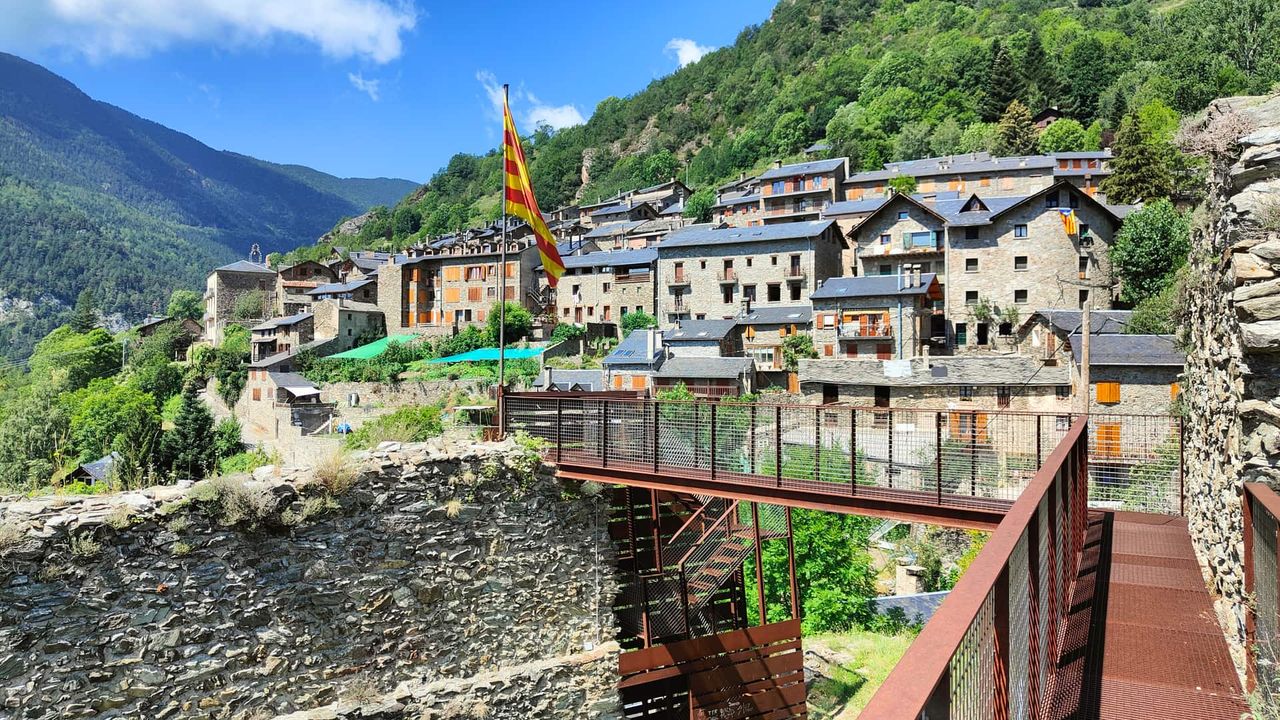
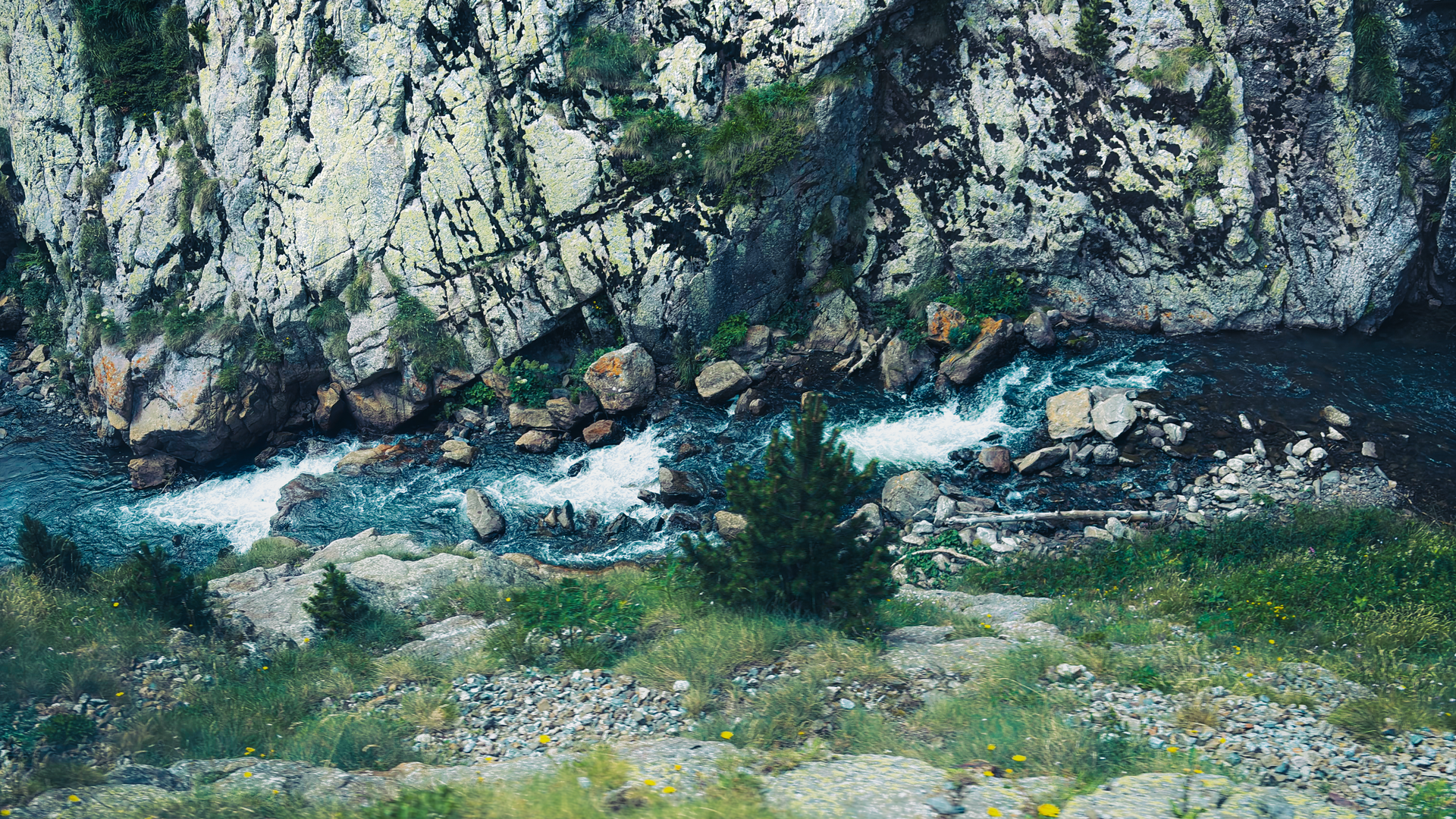
Once you're up at 1,964 m, the sanctuary and lake are only the start. The Creu d'en Riba viewpoint is a short, mostly flat walk from the station for the full view down the valley — do this even if you're not hiking further. If you'd rather earn the descent, the old Camí Vell trail drops back through the Gorges del Freser, a narrow granite-and-slate canyon the pilgrims used before the railway opened in 1931; it lands you back in Queralbs in about two and a half hours on foot, so only do it if you left the car there and have the legs for it.
Day 4 — Camprodon, Beget and Setcases in the Ter valley
Ribes de Freser to Camprodon is 38 km, about 35 minutes, over into a different Pyrenean valley — Camprodon is bigger and more formal than the villages so far, built around a 12th-century bridge with a single massive arch. It's a good base and a better lunch stop than a full sightseeing target.

Beget is the detour that makes the day: 18 km, about 25 minutes each way on a narrow paved road with passing places, no through-traffic, and — by design — very little phone signal once you're in the valley. The reward is a Romanesque church with an unusually large wooden Christ carving, in a village that genuinely has no other way to reach it. Go slow — the road is fine for any rental car, but it isn't built for two-way traffic at speed.

Back through Camprodon and 11 km northwest — about 15 minutes — Setcases sits at 1,270 m at the head of the valley, the last village before the Vallter 2000 ski road. In summer it's a hiking base with none of Camprodon's crowds; the stone houses and the Ter running through the middle are worth the short detour even if you're not lacing up boots. Overnight in Camprodon or Setcases.
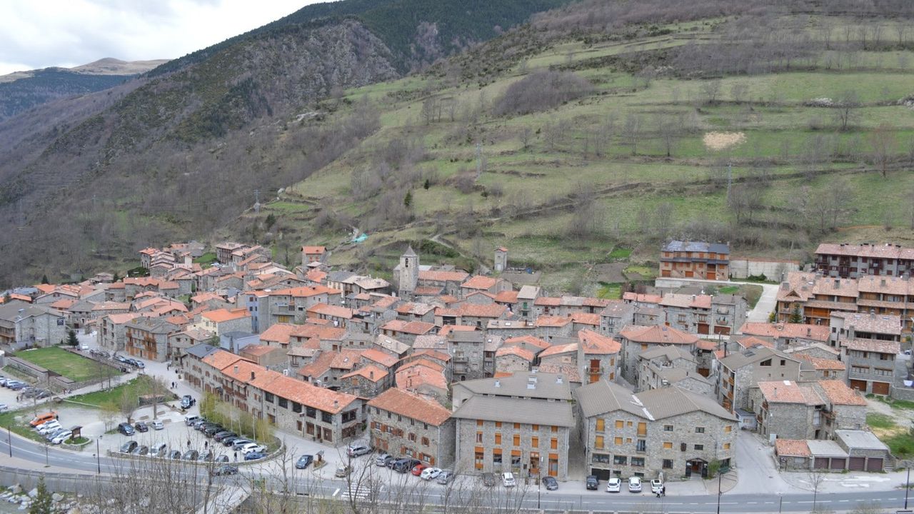
All told, this is the shortest driving day of the loop — well under 100 km even with the Beget road driven both ways — so let it be the slow one. If there's daylight left, the road past Setcases keeps climbing toward the Vallter 2000 ski station at the head of the valley, where the Ter starts out as a mountain stream — the same river that carved the Sau reservoir you looked down on from Tavertet.
Things to do in Catalonia
Paid links: booking through them supports YowJourney.
Day 5 — Down into the volcanoes of Garrotxa
Camprodon to the Vall d'en Bas is about half an hour south on the C-38/C-152, dropping out of the high Pyrenees into La Garrotxa's volcanic country. First stop is the Salt de Sallent, at over 100 m one of the tallest waterfalls in Catalonia, dropping off the edge of the very Collsacabra plateau you stood on two days ago — seeing it from below gives you the scale the clifftop views didn't.

Santa Pau, 20-odd minutes further, is the volcanic region's best-preserved village: a triangular medieval square, a ring of extinct craters around it, and the beech forest of the Fageda d'en Jordà within easy reach for a flat, easy walk under the trees. The Can Batlle waterfall, a short drive north, is a good stretch-your-legs stop — two tiers over basalt, usually cool even in August.

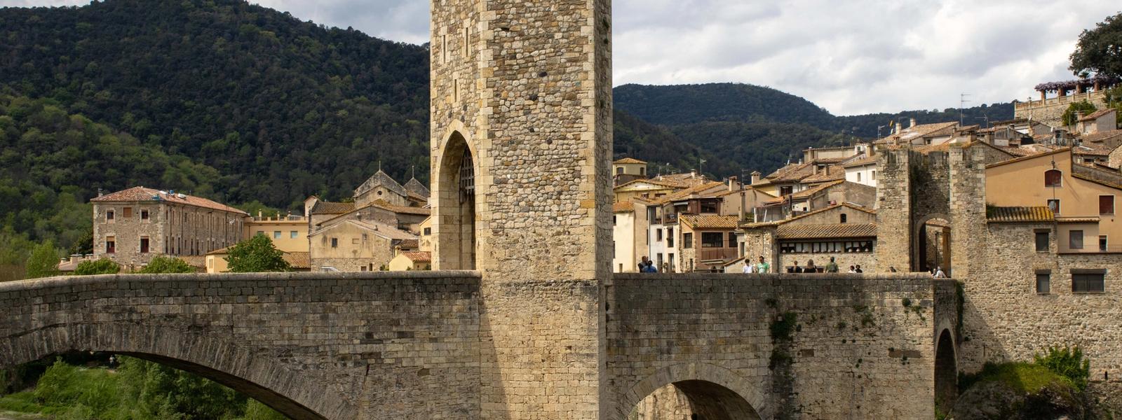
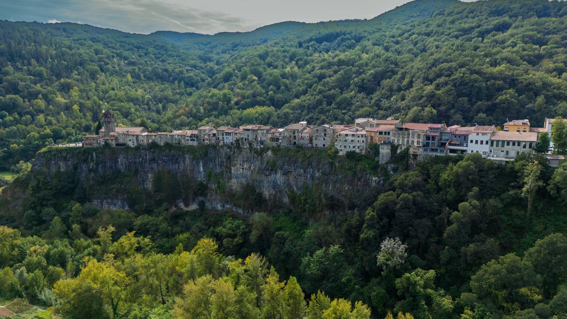
Castellfollit de la Roca is the region's postcard shot: houses built right to the edge of a 50-metre basalt cliff, formed by lava flows the Fluvià and Toronell rivers later cut through. Park at the edge of town and walk out — driving through doesn't show you the cliff at all. Besalú, 14 km and about 12 minutes on, is the day's overnight: an 11th-century fortified bridge — famously angular because its seven unequal arches sit on unevenly spaced riverbed rocks — is the entrance to the old town, and it's worth walking down to the riverbank to see the whole thing rather than just crossing it.

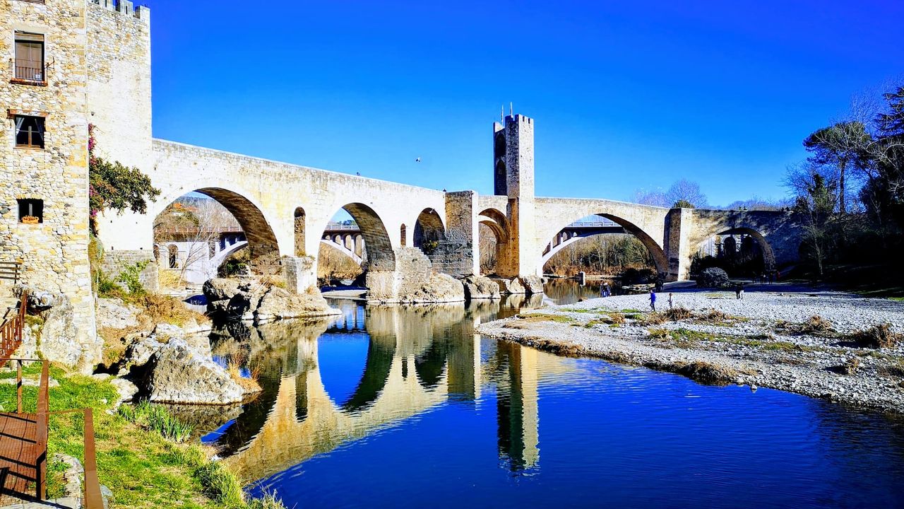
Of the two, Besalú is the practical overnight — spacious parking right at the town entrance, and the Fluvià reflecting the bridge arches once the day-trippers thin out. Castellfollit is the one you stop to photograph: the basalt face only reads from below, across the rivers that carved it — the angle the shot below was taken from.
Day 6 — Empordà castles to the edge of Cap de Creus
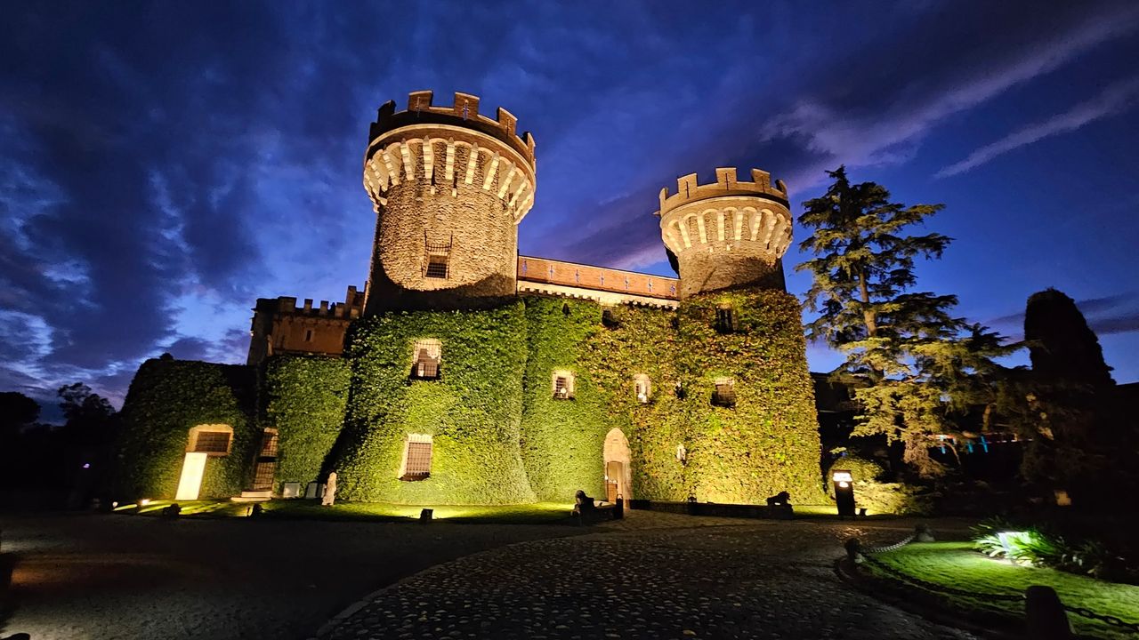
Besalú to Peralada is 36 km, about 30 minutes, out of the volcanic hills and into the flat Empordà plain. Peralada's castle began in the 9th century and was rebuilt as a French-style château; today it's part casino, part rare-book library, and the grounds host a well-regarded summer music festival — check what's on before you go, since festival weeks change access to parts of the park.

Sant Llorenc de la Muga
If medieval river villages are your thing, this is the detour: a fortified village held in a tight bend of the Muga, its walls, towers and bridges still reading as one defensive ensemble. The river pools below the fortifications are clear enough to swim in, with rest areas set out along the bank — worth keeping a towel in the boot before you commit to the coast.
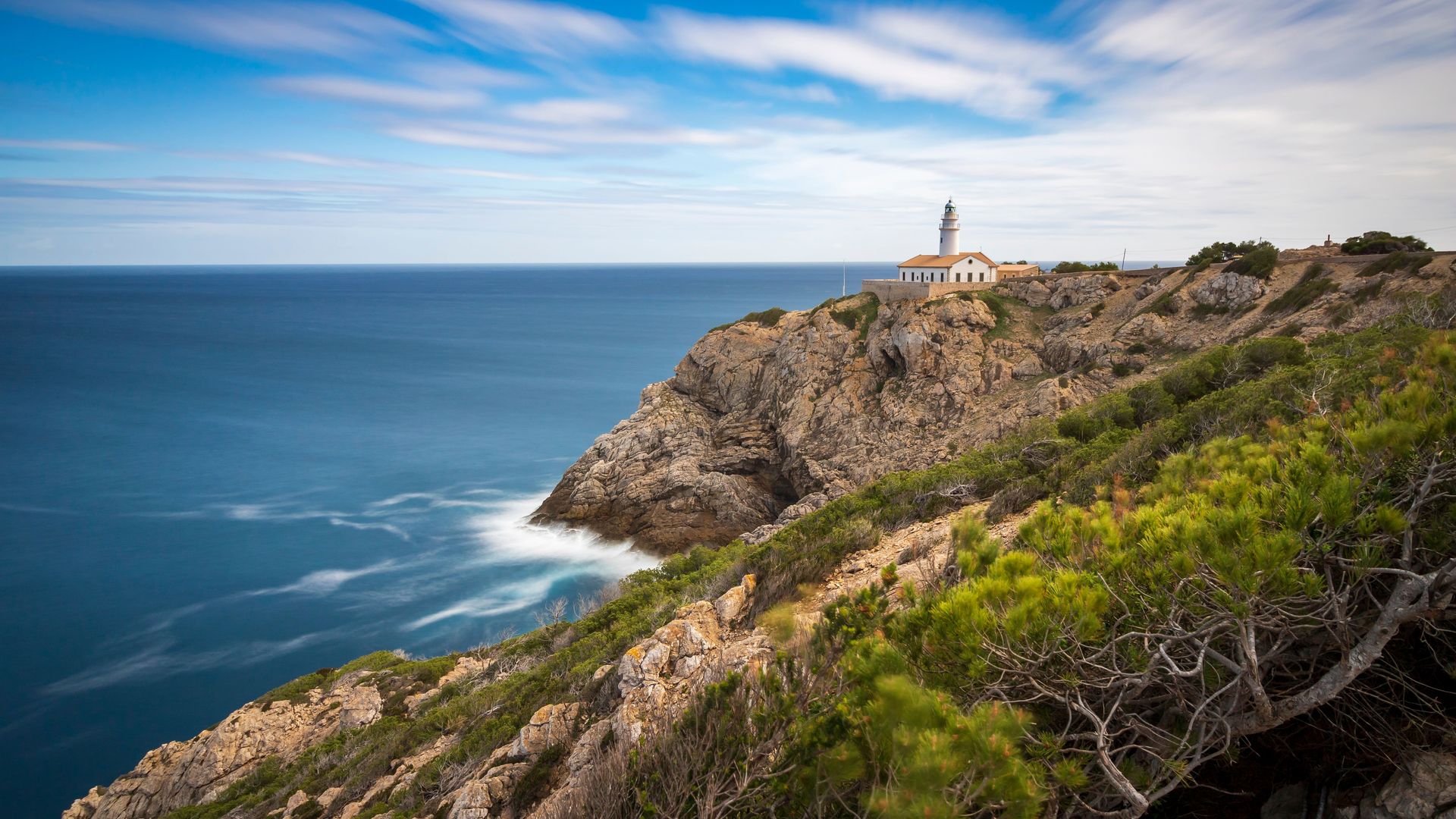
Peralada to Cadaqués is 37 km, about 40 minutes, and from there it's another 8 km (20 minutes) out to the Cap de Creus lighthouse road, where Cala Jugadora sits — a pebble cove reached by a 10-minute path from a small clifftop car park, famous enough for its water clarity that Dalí painted the rock formations around it. One thing to plan around: the lighthouse road closes to private cars on and off between late March and December — daily through the last days of March and again from June to September, but only on Saturdays and Sundays in April, May and October, plus a handful of scattered dates in November and December. Hours run roughly 9:30 am–7 pm in those shoulder weeks, stretching to 9:30 am–9:30 pm from June onward. The exact calendar shifts a little every year, so check the current dates on the park's own page (parcsnaturals.gencat.cat) before Day 6, or just use the shuttle bus from Cadaqués if you land on a closed one.

Sa Cova de s'Infern, a sea cave a 15-minute walk from the lighthouse along trail 15, is the other reason people come out this far — the name means Hell's Cave, for the reddish light the water takes on inside. You can only really see the inside from a kayak (rentals run from Cadaqués/Portlligat), but the cliff-top view of the entrance is free and takes ten minutes off the same path. Sleep in Cadaqués.
Day 7 — Baix Empordà villages and the coast home
The run back down to the Baix Empordà villages is about 50 km, under an hour, whichever way you cut it around the Roses bay. Peratallada is the standout — a village carved directly into sandstone bedrock, with defensive moats cut from the same rock rather than dug and filled, and wheel-rut grooves still worn into the old stone paving. Monells, 15 minutes away, is smaller and quieter, built around a single stone-arcaded square that's been the village market for centuries.

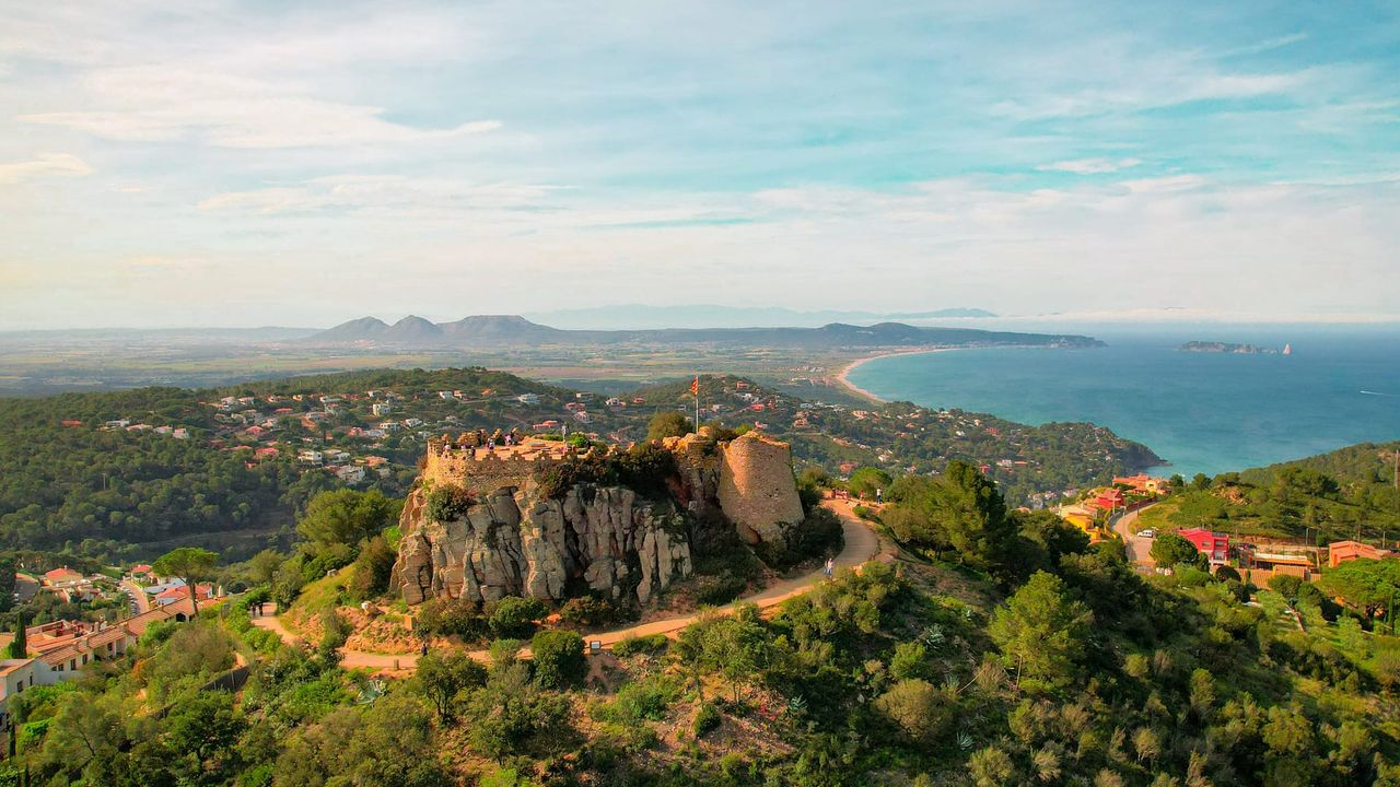
Pals and Begur are 20–25 minutes further toward the coast: Pals for the golden sandstone old town on its hill above the rice fields, Begur for the ruined castle at the top of the village, which has one of the best 360° viewpoints on this whole coast — the Medes Islands, the Pyrenees on a clear day, and the coves below, all at once. If you want one more cove stop, the Burricaires viewpoint near Palamós is a short detour on the way south.

From here it's a straight run home: Begur to Lloret de Mar is 67 km, about an hour, mostly on the C-31/C-32. Stop in Lloret for the Santa Clotilde Gardens — cypress-and-stone terraces cut into the cliff above Sa Boadella beach, quieter than the town's reputation suggests. Lloret to Canet de Mar is another 31 km, 20 minutes, for Santa Florentina Castle, a genuine medieval fortress remodelled into a Modernist showpiece by Domènech i Montaner (yes, the same building that played Horn Hill in Game of Thrones, if that means anything to you).


From Canet it's 47 km, about 30 minutes on the C-32, back into Barcelona. If seven stops in one day sounds like a lot, this is the day to cut — better to skip Burricaires or Santa Florentina than to arrive back exhausted and resentful of a beautiful castle.
Add it up and this is roughly 600 km over a week, not counting the walk down into Beget or the detour to the Cap de Creus lighthouse — a real road trip, but not an exhausting one, since no driving leg after Day 1 runs much past an hour. With more time, extend north into the Lleida Pyrenees (Vall de Boí's Romanesque churches, the Aigüestortes lakes) or south into Priorat wine country and the Ebro Delta — different terrain, different pace, each worth its own week rather than a bolt-on. Before you go, check the current Cap de Creus lighthouse-road closure calendar for Day 6 on the park's site; everything else on this route runs on ordinary opening hours.