Sandafell is a mountain above Þingeyri, in the Westfjords of Iceland. Road 626 climbs about halfway up it, and a dirt track continues from the car park to an antenna mast near the top. That track is the reason to come: the view opens on both sides, over the village on one and out along the fjord on the other. The walking is a steady uphill on gravel rather than a climb, and the mast makes a natural place to stop, though the ground carries on beyond it.
Sandafell Mountain
Local name: Sandafell
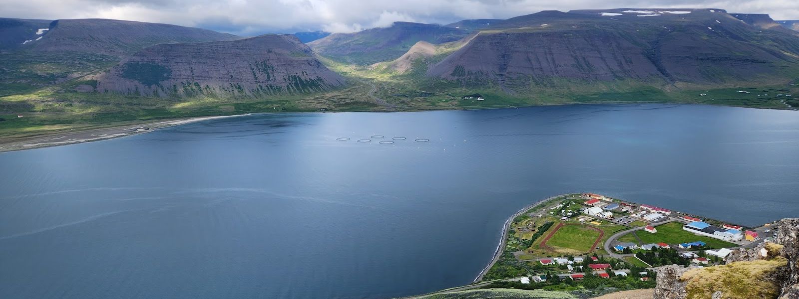
You can drive halfway up Sandafell in comfort, but the last stretch to the antenna mast is a 4x4 track with nowhere to turn around.
- Accessibility
- Not wheelchair accessible: no accessible parking, no step-free entrance, and the route up is a dirt and rock track.
- Parking
- Gravel car park part-way up the mountain on road 626, at the point-of-interest sign where the road on Google Maps ends. No marked accessible bays.
- Difficulty
- About 3 km (2 miles) uphill on dirt and rock, a steady incline with no flat stretches. 25–40 minutes on foot from the car park to the antenna mast.
- Hours
- Open 24 hours.
- Address
- 471 Þingeyri, Dýrafjörður, Westfjords
What makes it special
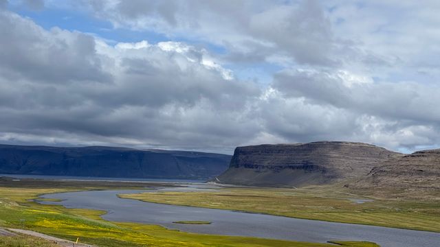
The pull at Sandafell is the view on both sides at once. It opens early on the way up and holds all the way to the antenna mast near the top. Þingeyri lies directly below, the whole village visible in one look. The fjord fills the other side.
Nothing about the walk is technical. It is a steady incline rather than a steep one, and it does not let up until the mast. Past the mast the ground carries on towards the edge, and people with time to spare keep going. Evening is what many come up for: this is the sunset viewpoint above the village.
Good to know
- Driving to the top: the track above the car park needs a high-clearance 4x4 with low range. A regular AWD SUV will not manage it.
- No 4x4 is no problem. The car park is reachable in an ordinary car, and the track above it is a walk rather than a scramble.
- No toilets at the car park. The nearest are down in Þingeyri, at the foot of the mountain.
- Gravel all the way. Road 626 up to the car park is gravel, and the track above it is loose dirt and rock.
Getting there
The approach starts in Þingeyri and follows road 626 up the mountain. An ordinary car gets about halfway, as far as the car park where the road on Google Maps ends. Everything above that point is a dirt and rock track: walk it, or drive it only in a high-clearance 4x4 with low range. The track climbs steadily to the antenna mast, and the ground past the mast is open to walk on towards the edge.
Best time to visit
Better: evening, timed for sunset from the upper part of the track.
Avoid: early spring, when road 626 has been listed as impassable beyond the car park.
Sunset is what people time the walk for, and with views opening on both sides of the mountain there is no single direction to face. In spring it is the gravel road, not the mountain, that decides whether you get up at all — the block sits well past the car park, which stays reachable.
Sun & daylight
Nearby Places


Similar Places


Featured in our guides
Sandafell Mountain on the map
Do not take a regular AWD SUV or a low 4x4 up the track above the car park. Sections of it are impassable, and there is nowhere to turn around — a vehicle that cannot go on has to reverse the whole way back down.
Get directions

Your whole travel map in one place
Get inspired by new places around the world and find the ones worth the journey
Frequently asked questions
Can you drive to the top of Sandafell?
Only in a high-clearance 4x4 with low range. The track above the car park defeats a regular AWD SUV, and sections of it are impassable. The alternative is to park where the road ends and walk up.How long does the walk take?
25 to 40 minutes from the car park up to the antenna mast, about 3 km at a steady incline. Beyond the mast the ground is open to walk on as far as the edge.Are there toilets at the car park?
No. Þingeyri, at the foot of the mountain, is the nearest place for them.What is the road up like?
Road 626 out of Þingeyri is gravel and reaches the car park about halfway up. Above that the surface is dirt and rock. The road further on is not always open — in April it has been listed as impassable, with the block well beyond the car park.