The Route of the 6000 Steps is a circular hiking trail of about 13 km in Vall de Laguar, in the hills inland from the Costa Blanca in Alicante province. It runs through the Gorge of Hell (Barranc de l'Infern), following a dry riverbed between canyon walls and climbing in and out on stone steps laid in Moorish times. The route has very few flat sections and takes from just under four hours to over five. A signboard near the start marks the PRV-147 and PRV-181 trails.
Route of the 6000 Steps
Local name: El Barranc de l'Infern (Ruta de los 6000 escalones)

Circular 13 km hike into a gorge on stone steps, with dry waterfalls, canyon viewpoints and a dry riverbed.
- Entrance
- Free; there is no ticket.
- Accessibility
- Not wheelchair accessible: the route is thousands of stone steps and a rough, stony riverbed.
- Parking
- Two free car parks, about 170 m and 320 m away in a straight line.
- Difficulty
- About 13 km loop with near-constant climbs and descents on stone steps and a stony riverbed; just under four hours to over five. Needs reasonable fitness and footwear with ankle support.
- Transport
- The nearest bus stop is about 1 km away in a straight line.
- Advance booking
- Not needed.
- Hours
- Open at any time.
- Address
- Partida Font Grossa, 1, 03791, Alicante, Spain
What makes it special
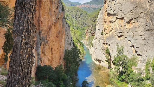
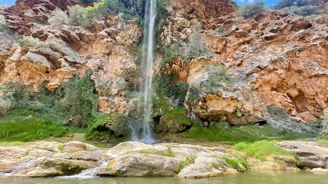
The path almost never stays level. Stone steps lead down into the gorge, the route follows the dry riverbed between walls of rock, past waterfalls that stand dry most of the time, and then the steps start again on the way out.
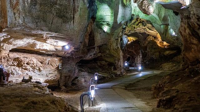
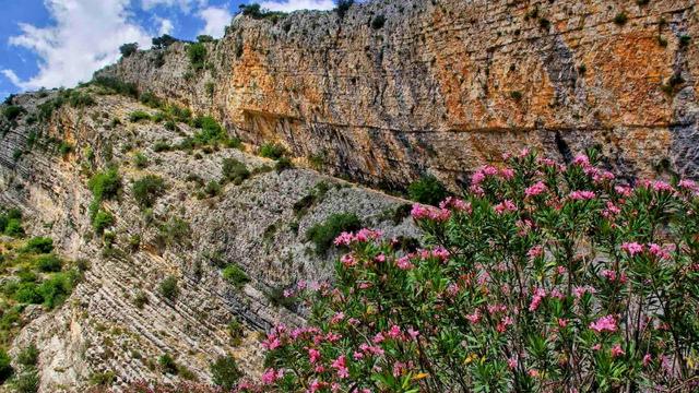
Viewpoints open over the canyons along the loop, and between them the gorge is very quiet. Wild boar move about in daylight, and the birdlife is worth watching for. The walk also reaches a cave with a fine echo and views out over the valley. The dry riverbed is the part people remember.
Good to know
- The loop is about 13 km and takes from just under four hours to more than five with stops; there are very few flat stretches.
- Wear boots with ankle support: the steps and the stony riverbed turn ankles easily, especially late in the walk.
- Carry the water and food you need for the whole loop before you set off.
- The nearest toilets, about 700 m away in a straight line, are for customers only; a water point is about 730 m away.
- The route is not suitable for wheelchairs or pushchairs.
Getting there
Two free car parks sit about 170 m and 320 m away in a straight line, and a guidepost marks the start of the route. A signboard for the PRV-147 and PRV-181 trails stands about 350 m away. The nearest bus stop is about 1 km away in a straight line. From the start, the whole loop is on foot, down into the gorge and back up on the steps.
Best time to visit
Best: spring and autumn, setting off early in the morning.
Avoid: summer middays, and the days during and after heavy rain.
A long climb on stone steps is hard going in Mediterranean summer heat, and rain can send water down the dry riverbed and leave the rock slippery. A clear winter day is walkable too.
Sun & daylight
Nearby Places
Similar Places

Featured in our guides
Route of the 6000 Steps on the map
The stone steps and loose rock of the riverbed turn ankles easily, and the gorge floor can flood after heavy rain. Wear boots with ankle support and stay out of the gorge when rain is forecast.
Get directions

Your whole travel map in one place
Get inspired by new places around the world and find the ones worth the journey
Frequently asked questions
How long does the Route of the 6000 Steps take?
The 13 km loop takes from just under four hours to more than five, including stops for rest and food.How hard is the Route of the 6000 Steps?
It needs a reasonable level of fitness. The path climbs and drops almost all the way round, with very few flat sections, and the steps and stony riverbed are hard on tired legs and ankles.What footwear do you need?
Boots or shoes that support the ankle. Twisting an ankle on the steps and the riverbed stones is easy, especially towards the end of the walk.What do you see along the way?
The Gorge of Hell (Barranc de l'Infern) with its dry riverbed and dry waterfalls, canyon viewpoints, a cave, and often wild boar and birds.