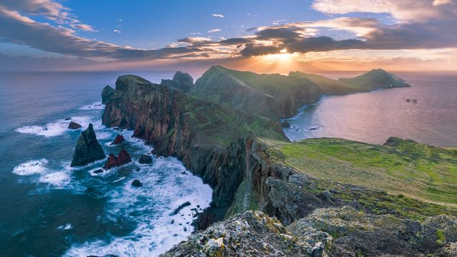
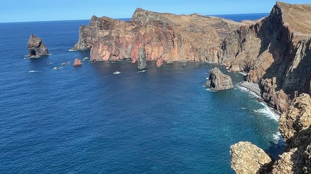
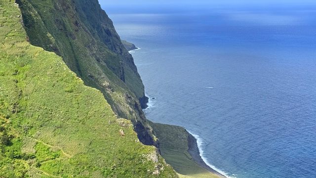
São Lourenço Point is the easternmost tip of Madeira, in the town of Caniçal, in the municipality of Machico. It has been a nature reserve since 1982. The headland is bare: rock and low herbaceous vegetation, pyroclastic cliffs cut by basalt dykes, sea on both sides. A marked footpath, the PR8, runs from the entrance out to the far end and takes about an hour. Entry is by booked time slot, and the walk is what people come for.
São Lourenço Point
Local name: Ponta de São Lourenço

The islets off the tip, Ilhéu do Farol and Ilhéu da Cevada, hold the largest Caspian gull colony in Madeira.
- Entrance
- Entry is by permit, checked at the entrance to the trail.
- Accessibility
- The entrance is not wheelchair accessible. Beyond it the route is a footpath over rock.
- Parking
- Free car park and free roadside parking at the entrance, plus a paid lot. Spaces near the entrance are limited: park 500 m or further away and you walk that back after the hike.
- Difficulty
- Easy to moderate. The path is well marked and takes about an hour from the entrance. The surface is rock, so wear shoes with grip rather than city trainers.
- Transport
- Baía d'Abra bus stop, approximately 50 metres away.
- Advance booking
- Required. Entry runs on timed slots, and booking about a week ahead is advisable for this trail.
- Hours
- Open 24 hours.
What makes it special
This is the treeless end of Madeira. Rock and low scrub run out to the sea, with cliffs on both sides and water in view left and right for most of the walk. The rock is young. Pyroclastic layers cut by basalt dykes were built up around 100,000 years ago, and the sea has been eating the coast back ever since.
The reserve has protected its endemic plants since 1982, among them Matthiola maderensis, Echium nervosum and Andryala glandulosa. Offshore lie the islets, the farthest being Ilhéu do Farol with its lighthouse. Porto Santo sits to the north-east, the Desertas to the south-east. The PR8 path strings the viewpoints together, and the one at the far end is the reason to walk the whole way.
Good to know
- No shade — the route crosses open rock, and on a hot day there is nowhere to get out of the sun. Carry more water than you expect to drink.
- Toilets cost money — a portable one before the trail at 2 €, and the restaurant at the far end at 1 €. Nothing in between.
- It is busy — one of the most popular walks on Madeira, and timed entry does not make it feel quiet.
- Dogs are allowed on the trail.
Getting there
The reserve is at the eastern end of the island, in Caniçal, and the approach is by road. There is a car park and roadside parking at the entrance, and everything beyond the entrance is on foot. The path takes about an hour out to the far end, then back the same way. If you park a long way down the road, add that stretch at both ends of the day. There is also a viewpoint you can drive to, which shows the peninsula from another side; it works well on the way out.
Best time to visit
Better: early in the day, and when the wind is light.
Avoid: the hottest part of a clear day.
The spaces near the entrance go first, so an early start decides how far you park from the gate. The path has no shade at any point, which makes heat the limiting factor rather than distance. Wind is the other one: it can be strong enough to unbalance you.
Sun & daylight
Nearby Places
Similar Places


São Lourenço Point on the map
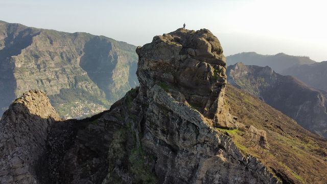
The wind is the hazard here, not the path. Gusts arrive without warning, strong enough to knock you off balance and to fling loose stones. At the far end, the climb up Ponta do Furado is officially closed: the steps have broken up, and the railings and wires are rusty and spiky. People still go up it anyway. Do not follow them.
Get directions

Your whole travel map in one place
Get inspired by new places around the world and find the ones worth the journey
Frequently asked questions
Do you need a permit?
Yes. Entry runs on booked time slots and is checked at the entrance to the trail. Slots for this route go quickly, so book well before the day you want.Can you climb Ponta do Furado at the end of the trail?
It is officially closed. The steps are deteriorated and the railings and wires are rusty and spiky. A steady stream of people still goes up, which does not make it safe.Will you see seabirds and monk seals?
The headland and its islets are recognised as an Important Bird Area for their seabird colonies, and monk seals live in the surrounding waters. A walk along the path may turn up nothing more than gulls and kestrels.Is there anywhere to buy food or drink?
There is a buffet at the far end of the trail with refreshments and a restroom. Between it and the entrance there is nothing, so carry your own water.