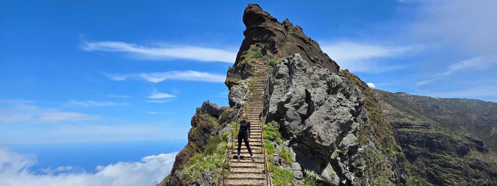
Vereda do Areeiro is a waymarked mountain trail starting at Pico do Areeiro, in the Santana area of Madeira. It follows the open ridge through tunnels cut into the rock and over long flights of steps, with railings along most of its length and steep drops on either side. Entry is ticketed. Many walkers cover only the first section and turn back, and cloud regularly sits on the ridge and hides the panorama completely.
Vereda do Areeiro Trail
Local name: PR1 Vereda do Areeiro
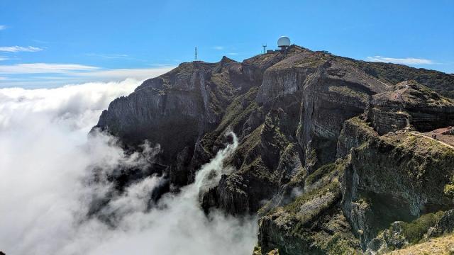
Behind the air force radar tower at the top there is a second viewpoint that most walkers head past without noticing.
- Entrance
- Paid entry; ticket required. Cards accepted.
- Accessibility
- Not suitable for wheelchairs or prams: stairways, rock tunnels and narrow ridge walkways throughout.
- Parking
- Free asphalt car park 62 m from the trailhead; paid car park 134 m away. Both scarce and tight; dirt overflow area further down the road.
- Difficulty
- Moderate. Steps, tunnels and narrow walkways on an exposed ridge, railings along most of it; first section about 1.5 hours return.
- Transport
- Nearest bus stop, Pico Furão-Final, is about 3.4 km away; visitors drive.
- Advance booking
- Tickets can be bought online in advance.
- Hours
- Daily, 7am–7.30pm.
What makes it special
The trail runs along the open ridge at Pico do Areeiro, and the ground falls away on both sides for much of it. Tunnels are cut straight through the rock, long flights of steps drop into the saddles and climb out again, and in places the walkway narrows to single file. On a clear day the view runs out across the interior peaks. On a cloudy one the ridge sits inside the cloud, the drops disappear into white, and the walk turns into something else entirely: steps and tunnel mouths surfacing out of the mist a few paces ahead. Cloud also breaks up as the morning goes on, and the panorama can arrive halfway through the walk.
Good to know
- Closures: sections of the trail close. In May 2026 one walker could cover only about 1.7 km before turning back.
- Water: there is no drinking water point at the trailhead or anywhere near it, so carry what you need.
- Toilets: the toilets by the trailhead charge a fee.
- On site: a snack bar sells snacks, drinks and souvenirs; cards are accepted.
- Dogs: dogs are allowed.
Getting there
The mountain road runs right to the top, and the car park sits at the trailhead, some 60 metres from the start, so there is no approach walk to speak of. Space is scarce and tight. When the tarmac is full, there is a dirt overflow area further down the road, and the walk back up to the start is on the road itself. An information point stands within a few paces of the trailhead.
Best time to visit
Better: first light for sunrise, or from around 5pm for the evening and sunset.
Avoid: the hours in between, when parking is at its tightest.
By early evening the trail is markedly quieter and there is a realistic chance of a space in the car park. Cloud is the other variable: it can cover the ridge for a whole day and hide the panorama completely, and it can also clear during the walk.
Things to do nearby
All tours in Curral das Freiras on GetYourGuide
Paid links: booking through them supports YowJourney.
Sun & daylight
Nearby Places
Similar Places


Vereda do Areeiro Trail on the map
The ridge is exposed, with steep drops on both sides and walkways that narrow above them. Railings run along most of the route, and there are stretches without them. Wind on the open sections can be strong — keep back from the edge and watch your footing there.
Get directions

Your whole travel map in one place
Get inspired by new places around the world and find the ones worth the journey
Frequently asked questions
Do you need a ticket for the trail?
Yes, entry is ticketed. Tickets can be bought online before you arrive, and cards are accepted on site.How long does the walk take?
The first section takes about an hour and a half there and back, photo stops included. You can turn round wherever you like and walk back the same way.Can the trail be closed?
Sections do close. In May 2026 a walker was able to cover only about 1.7 km before the closed part, so check the state of the route before setting out.Are there toilets, water and food at the start?
There are toilets by the trailhead and they charge a fee, and a snack bar sells snacks, drinks and souvenirs. There is no drinking water point nearby — bring your own.Is the trail suitable for children or anyone afraid of heights?
It is a moderate mountain walk on an exposed ridge with steep drops, stairways and narrow walkways. Railings cover most of the route, but the exposed ridges demand full attention, especially in wind.