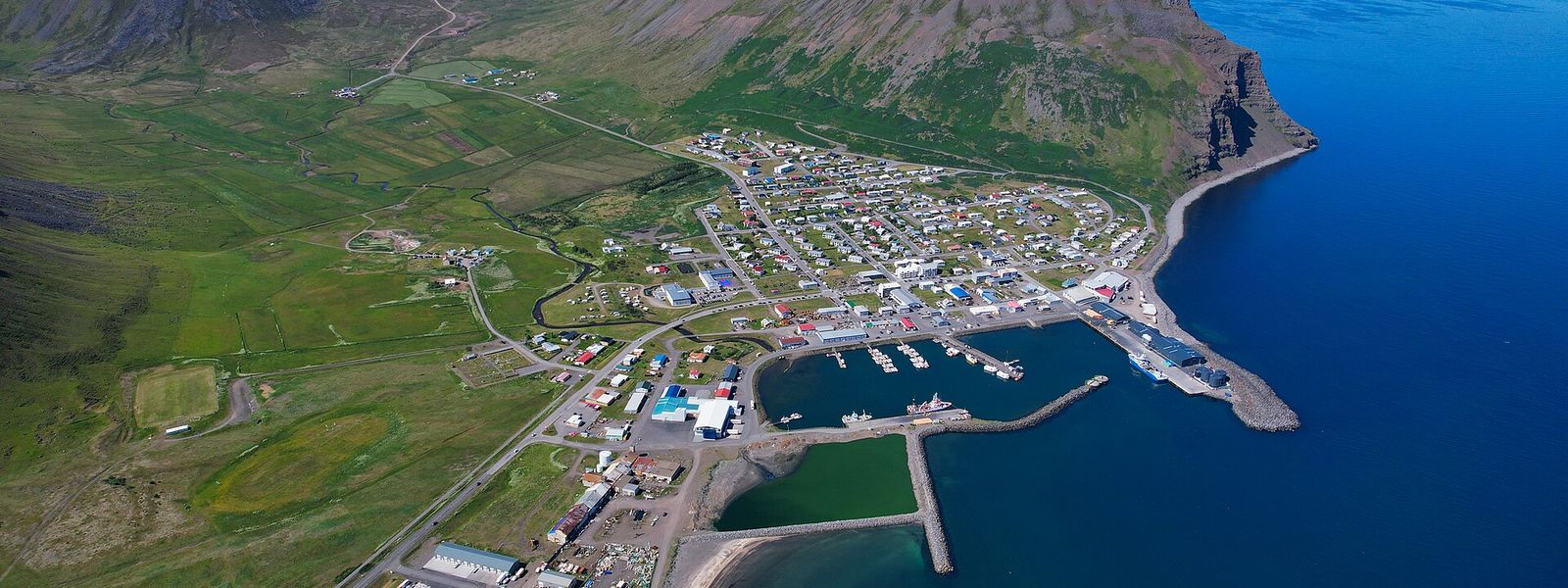
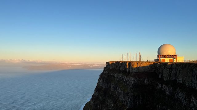
Bolungarvík is a small town on the Westfjords peninsula in north-west Iceland and the only built-up area in its municipality. The bay has been worked as a fishing outpost since the 17th century, one of the earliest in Iceland, and no road reached the village until 1950. The Ósvör Maritime Museum keeps a restored 19th-century fishing hut. A gravel road climbs Bolafjall, 638 m above the town, for views over Ísafjarðardjúp and out to the Denmark Strait.
Bolungarvík
- Currency
- Icelandic króna (ISK)
- Language
- Icelandic; nearly all speak English
- Power plug
- Europlug and Schuko sockets, 230 V
- Visa
- Schengen; outside the EU
- Time zone
- UTC±00:00 (Atlantic/Reykjavik)
- Tap water
- Safe; hot water smells of sulphur
- Tipping
- Not customary
- Emergency
- 112
Things to do
All tours in Bolungarvík on GetYourGuide
Paid links: booking through them supports YowJourney.
When to go
High season
Jun – Aug
The gravel road to Bolafjall and Skálavík is open, and at 66°N there is light almost all night.
Shoulder
Sep – Oct
The mountain road closes and daylight shortens fast. Only the tunnel road to Ísafjörður stays in use.
Low season
Nov – Mar
Subarctic winter with very short days. The tunnel keeps the link to Ísafjörður open where the old coastal road used to fail.
Shoulder
Apr – May
Daylight returns quickly, but the road up Bolafjall stays shut until June.
How long to stay
A night is enough for the town itself. The two museums and the swimming pool fill half a day, and many people come over from Ísafjörður and leave the same afternoon. Allow a second day from June to August, when the gravel road to Bolafjall and Skálavík is open and the walking in the surrounding hills is in season.
Getting around
The approach is by car from Ísafjörður, 14 km away. Since 2010 that road runs through the Bolungarvíkurgöng tunnel under Óshlíð. It replaced a coastal stretch that was regularly hit by avalanches and rock falls. Reykjavík is 473 km away by road.
The town has under a thousand residents and is small enough to cross on foot. One gravel road leads out of it to Skálavík bay and to the top of Bolafjall, 638 m above the town. That road is open from June to August only. Outside those months the mountain and the bay are out of reach by car.
What to see


Destinations in Bolungarvík
Frequently asked questions
Where is Bolungarvík?
On the Westfjords peninsula in north-west Iceland, 14 km from Ísafjörður and 473 km from Reykjavík. It is the only built-up area in the municipality of Bolungarvíkurkaupstaður.What is there to see in the town?
The Ósvör Maritime Museum, built around a restored 19th-century fishing hut, and a natural history museum with taxidermied animals including a polar bear and the largest bird collection in Iceland. There is also an indoor swimming pool with outdoor hot tubs and a water slide.Can you drive up Bolafjall?
Yes, on a gravel road that is open from June through August. The summit is 638 m and looks over the town, Ísafjarðardjúp, the Jökulfirðir fjords, the Hornstrandir nature reserve and the Denmark Strait. The same road serves Skálavík bay.How old is the settlement?
Landnámabók places the first settlers here around 940. The bay has been used as a fishing outpost since the 17th century, one of the earliest in Iceland. No road reached the village until 1950.Which films were shot in Bolungarvík?
Nói Albínói by Dagur Kári, and Rúnar Rúnarsson's Sparrows of 2015, which was filmed here in part. The 2015 film Albatross by Snævar Sölvi Sölvason is set in the town.