Eldgjá is a canyon and volcanic fissure in South Iceland, between Landmannalaugar and Kirkjubæjarklaustur. It belongs to the Katla volcanic system and is the longest volcanic fissure in the country: a graben about 8.5 kilometres long, 600 metres wide and 150 metres deep, part of a 40-kilometre chain of craters. Around 939 it produced the largest effusive eruption of the last few millennia. Walking trails run along the floor of the fissure to the Ófærufoss waterfall.
Eldgjá Canyon
Local name: Eldgjá
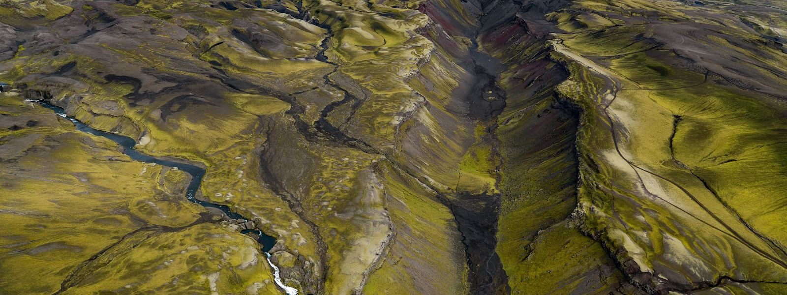
The eruption that opened this fissure around 939 laid down 18.6 cubic kilometres of lava and cooled the Northern Hemisphere — tree rings record a drop of 0.7–1.5 °C in 940.
- Entrance
- Free
- Accessibility
- Limited — remote, rough terrain and a river crossing, no facilities
- Parking
- Car park by the canyon at the end of the F208 spur
- Difficulty
- Walking is on the floor of the canyon. A trail leads to Ófærufoss; a longer route runs about 15 kilometres there and back.
- Transport
- 4x4 only — F208 with unbridged fords; summer only
What makes it special
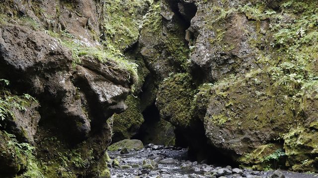
The path here runs along the floor of the fissure itself. Moss covers much of the rock, in shades from grey to bright green, and the far end of the gorge is barren. Ófærufoss drops into the main fissure at the lower end; a natural rock bridge stood over the falls until it collapsed in the early 1990s. Around 939 this fissure fed the largest effusive eruption of the last few millennia — 18.6 cubic kilometres of lava spread over 780 square kilometres of land. Expectations are worth calibrating: one visitor found the area beautiful but not particularly spectacular.
Good to know
- Ford on the way in. Route 208 crosses a stream with no bridge. One visitor forded it in late June, after morning rain, and found the water shallow.
- Rockfall. Large boulders come down in the first part of the gorge at the end of winter.
- Two walks. A trail leads to the waterfall; a longer route runs about 15 kilometres there and back.
- On site. Eldgjá has information centres and picnic places; one covers the local birds and plants.
- Protected ground. The northern part, with Ófærufoss, lies in Vatnajökull National Park; all of Eldgjá lies in Katla Geopark.
Getting there
Eldgjá is reached by car on Route 208, driving south. The road crosses a stream with no bridge, so the last stretch involves a ford; a visitor who crossed in late June, after morning rain, found the water shallow. From there the walking is inside the canyon itself. One trail leads to Ófærufoss at the lower end of the gorge, and a longer route covers about 15 kilometres there and back. Eldgjá lies between Landmannalaugar and Kirkjubæjarklaustur.
Best time to visit
Better: late June. A visitor who crossed the ford on Route 208 at that time found the water shallow, the moss on the walls a vivid green and the colour range across the rock at its strongest.
Avoid: the end of winter. That is when large boulders come down in the first part of the gorge.
The canyon draws few people. One visitor described feeling like the only person in the world down there.
Access & restrictions
The northern part of Eldgjá, including Ófærufoss, has been inside Vatnajökull National Park since 2011, and the whole fissure has been part of Katla Geopark since 2010. Drone flights are not automatic here: one visitor photographed the gorge from the air only after obtaining written permission from a park ranger.
Sun & daylight
Nearby Places


Similar Places

Eldgjá Canyon on the map
Large boulders come down in the first part of the gorge at the end of winter. The road in, Route 208, crosses an unbridged stream, and the depth of the ford depends on rain.
Get directions

Your whole travel map in one place
Get inspired by new places around the world and find the ones worth the journey
Frequently asked questions
How big is Eldgjá?
The named canyon is about 8.5 kilometres long, 600 metres wide and 150 metres deep. It is one segment of a 40-kilometre chain of craters and fissure vents running north-east from Katla, and the longest volcanic fissure in Iceland.Is there a waterfall inside the canyon?
Ófærufoss lies in the main Eldgjá fissure. A natural rock bridge once spanned the falls and was heavily photographed; it collapsed in the early 1990s.How long is the walk?
A trail leads to the waterfall at the lower end of the gorge. A longer route runs about 15 kilometres there and back, inside the fissure.Why does the 939 eruption matter?
It was the largest effusive eruption of the last few millennia: 18.6 cubic kilometres of lava over 780 square kilometres. It cooled the climate, and severe winters and food crises across Eurasia between 939 and 942 are linked to it.Is Eldgjá protected?
Yes. The northern part, with Ófærufoss, has been in Vatnajökull National Park since 2011, and the whole of Eldgjá has been in Katla Geopark since 2010.