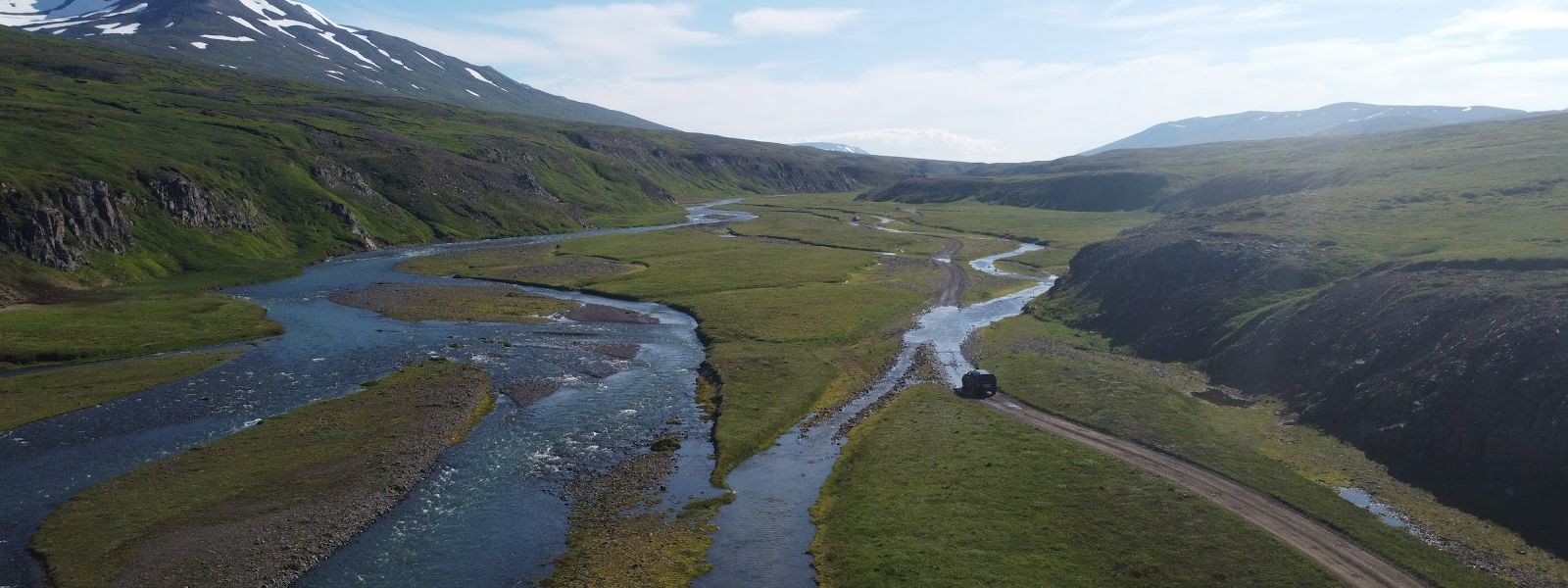
Flateyjardalur is a valley in Northeast Iceland, on the Flateyjarskagi peninsula by Skjálfandi bay. It stretches about 33 km from the coast south to Fnjóskadalur, almost perfectly straight, with a small bend at the seaward end. The name comes from Flatey, the island just off the shore. The last inhabitants left the coast in 1953, and three concrete houses from the late 1920s are now used only in summer. The road in, built the same year, comes from Fnjóskadalur, and the drive down to the beach crosses rivers at unbridged fords.
Flateyjardalur Valley
Local name: Flateyjardalur
When the valley emptied, the church at Brettingsstaðir was taken apart and moved out to the island of Flatey; the graveyard still surrounds its empty foundation.
- Entrance
- Free
- Difficulty
- Hard — remote; a rough 4x4 track or a long hike
- Transport
- 4x4 only, over Flateyjardalsheiði; no public transport
- Address
- 607 Flateyjardalsheiði, Iceland
What makes it special
Flateyjardalur has been deserted since 1953, when the last inhabitants left the coast. Three concrete houses built in the late 1920s still stand, and they are lived in only over the summer. By the old farm Brettingsstaðir there is a cemetery around the bare foundation of a church; the church itself was dismantled and moved out to the island of Flatey once the valley had emptied.
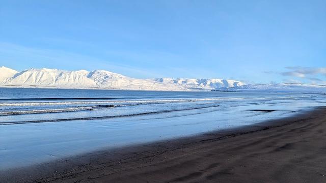
The valley runs almost dead straight for about 33 km from north to south, from the coast up to Fnjóskadalur, with one small bend near the sea. The drive between the mountains is the visit for most people, and it ends at a beach with cliffs. Finnboga saga ramma, one of the Icelandic sagas, is set in this area.
Good to know
- Vehicle: the rivers on the way to the beach are crossed at unbridged fords. AWD or 4WD is required to drive the whole way.
- Nobody lives here: the last residents left in 1953, and the valley has had no permanent population since.
- Summer place: visitors come in summer, and summer is the only season the three concrete houses are occupied.
- The way in: the road to Flateyjardalur comes from Fnjóskadalur and was built in 1953.
Getting there
The road in comes from Fnjóskadalur, built in 1953 to connect the abandoned coast with the rest of the region. From there the route runs north down the valley between the mountains, about 33 km almost in a straight line, and it ends at the beach. Driving the whole way means fording rivers that carry no bridges — a dozen or more crossings. AWD or 4WD is required for them.
Best time to visit
Best: summer.
Avoid: the fords when the rivers are running high after rain.
Flateyjardalur takes its visitors in summer, and summer is also the only season the three houses in the valley are occupied. The rivers between the road and the coast have no bridges, so their level decides whether the beach can be reached at all.
Sun & daylight
Nearby Places



Similar Places


Flateyjardalur Valley on the map
The rivers between the road and the beach are crossed at fords, with no bridges over any of them, and there are a dozen or more. AWD or 4WD is required. The valley has had no permanent residents since 1953.
Get directions

Your whole travel map in one place
Get inspired by new places around the world and find the ones worth the journey
Frequently asked questions
Do you need a four-wheel drive?
To drive the whole way to the beach, yes. The route crosses a dozen or more rivers at unbridged fords, and AWD or 4WD is required.Does anyone live in Flateyjardalur?
No. The last inhabitants left the coast in 1953. Three concrete houses from the late 1920s remain, and they are used only during the summer.How long is the valley?
About 33 km. It runs almost perfectly north to south, from Fnjóskadalur down to the coast on Skjálfandi bay, and bends only slightly near the sea.Where does the name come from?
From Flatey, the island lying just off the shore. The old church of Brettingsstaðir was moved to that island after the valley was abandoned.