Kirkjufell is a 463-metre hill on the north coast of the Snæfellsnes peninsula in West Iceland, beside the town of Grundarfjörður. It is often called the most photographed mountain in the country, and the usual view is taken from the waterfalls on the other side of the road. Geologically it is a nunatak: volcanic rock that stood above the Ice Age glaciers, built of layered lava and sandstone with tuff at the summit. Game of Thrones filmed here in seasons 6 and 7.
Kirkjufell
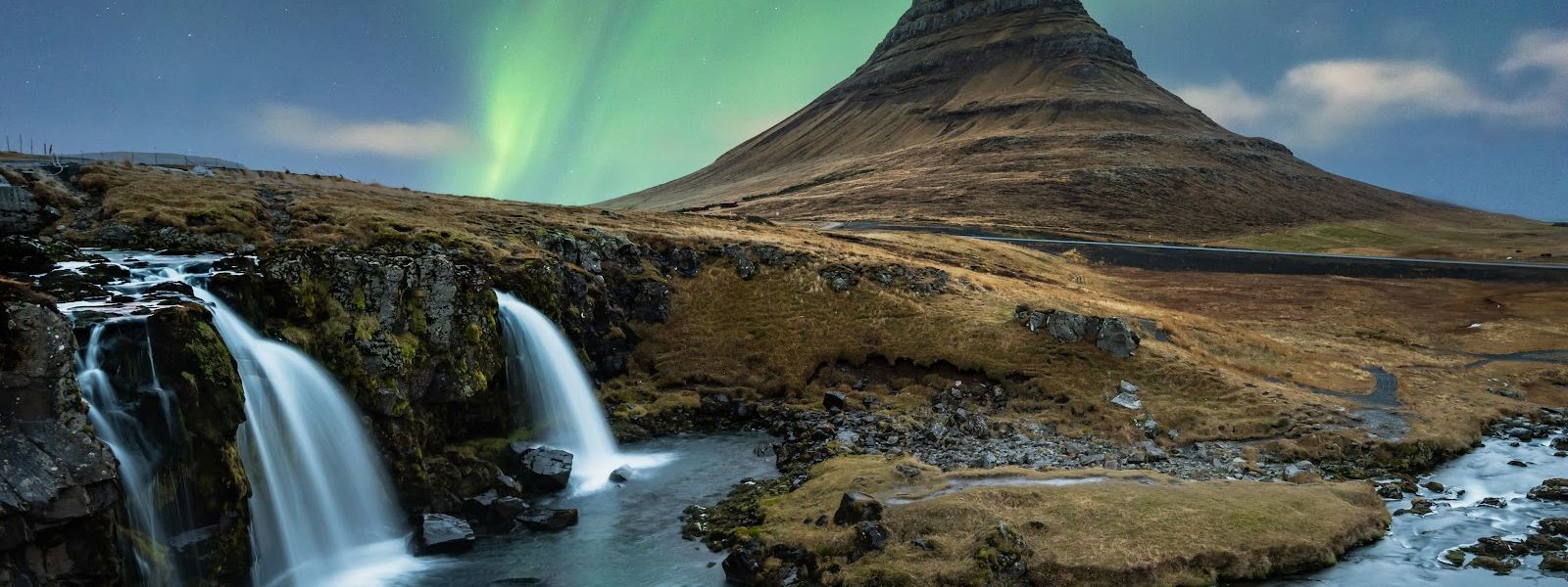
Kirkjufell played the arrowhead mountain north of the Wall in Game of Thrones, seasons 6 and 7.
- Entrance
- Free
- Parking
- Paid parking across the road from the mountain. Walking round the mountain from the town avoids the fee.
- Difficulty
- Summit climb about 3 hours, summer and autumn only. Steep, exposed sections that are dangerous when wet.
- Transport
- Self-drive (coast road by Grundarfjörður)
- Address
- Kirkjufell, 351 Grundarfjörður
What makes it special
Kirkjufell is a nunatak. During the Ice Age it stood above the glaciers that ground down the ground around it, and what is left is a single steep cone on the coast. The rock is volcanic, but the mountain has never been a volcano. Its strata are alternating Pleistocene lava and sandstone, with tuff at the summit.
The shape is the draw: near-cylindrical, 463 metres, standing on its own against the sea. Across the road are the waterfalls of Kirkjufellsfoss and a walking path, and that is where the standard photograph comes from, water in front and the cone behind. Sheep graze loose over the ground beside the path.
Good to know
- The climb takes about three hours and is done in summer and autumn.
- Not for a fear of heights — the summit route is exposed.
- The classic photograph is taken from across the road, on the path beside the waterfalls.
- This is one of the busiest photo stops in Iceland. Early morning clears it: at 4am in June the place can be empty.
- Sheep graze loose around the mountain, including beside the path.
Getting there
Kirkjufell stands on the coast just outside Grundarfjörður, and you see it well before you stop. Cars pull in on the far side of the road from the mountain, where the waterfalls and the walking path are; that path, not the mountain itself, is where almost every photograph is taken. From Grundarfjörður it is also possible to reach the mountain on foot and walk right round it. Climbing to the summit is a separate undertaking, not a stroll from the roadside.
Best time to visit
Better: early morning, and summer or autumn if you intend to climb.
Avoid: wet weather and bad weather on the mountain itself.
The path opposite the mountain is one of the most photographed spots in Iceland and fills up during the day; at 4am in June it can be deserted. The mountain is also a known place to watch the northern lights, which asks for dark, clear nights rather than a particular hour. On the climb, the steep sections stop being safe as soon as the rock is wet.
Sun & daylight
Nearby Places


Similar Places

Kirkjufell on the map
The steep sections of the climb become dangerous when wet or in bad weather. Falls from Kirkjufell have killed people in 1945, 2017, 2018 and 2022. Do not start up in rain or low cloud.
Get directions

Your whole travel map in one place
Get inspired by new places around the world and find the ones worth the journey
Frequently asked questions
How long does it take to climb Kirkjufell?
About three hours. The climb is done in summer and autumn, and the steep sections become dangerous when wet or in bad weather.Is Kirkjufell a volcano?
No. It contains volcanic rock but is not itself a volcano. It is a nunatak, a mountain that protruded above the surrounding glaciers during the Ice Age, made of alternating Pleistocene lava and sandstone with tuff at the summit.What does the name mean, and how high is the mountain?
Kirkjufell means Church Mountain in Icelandic. It is 463 metres high and stands on the north coast of the Snæfellsnes peninsula, near Grundarfjörður.Is Kirkjufell a good place for the northern lights?
It is a popular spot for aurora watching and photography, with the cone as the foreground. Dark, clear nights are the condition.