Los Órganos is a waymarked hiking route in the forested highlands of La Orotava, on the northern side of Tenerife in the Canary Islands. It runs through Canary pine with an understorey of tree heath (Erica arborea), and native plants including the Canary orchid grow along the way. The name comes from the rock faces on the route, where vertical columns of volcanic rock stand side by side like the pipes of an organ.
Los Organos Trail
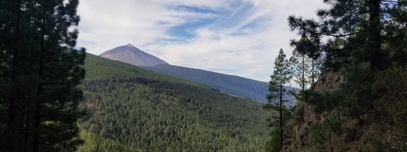
Forest footpath through Canary pine and tree heath above La Orotava, named after its organ-pipe rock.
- Entrance
- Free; the trail is open forest with no ticket.
- Accessibility
- Unpaved forest footpath with slippery descents and stretches without railing; not suitable for wheelchairs or pushchairs.
- Parking
- Parking La Caldera, about 1.2 km away in a straight line; a second car park about 1 km away.
- Difficulty
- Mountain forest path, soft with pine needles and slippery on the descents, with unrailed stretches and waymarks that are easy to lose.
- Transport
- Bus to the Aguamansa stop, about 1 km away in a straight line; buses run up from Puerto de la Cruz.
- Hours
- Open at all hours; walk it in daylight.
- Address
- Unnamed Road, 38300, 38300, Santa Cruz de Tenerife, Spain
What makes it special
Underfoot the path is a mat of pine needles, soft enough that the walking feels easy. Most of it runs in the shade of the trees, so the forest stays pleasant even under a hot sun.
Cloud often settles right in the pines. On those days there is no view at all: damp trunks, dripping heath and a quiet that feels close to mystical. When it lifts, some stops along the path open onto the slopes below.
Look down as well as out. Tree heath, escobón (Chamaecytisus proliferus), the small succulent Aichryson laxum and two wild orchids, Neotinea maculata and Orchis canariensis, grow along the route.
Good to know
- Waymarking is patchy. Posts exist, but they are easy to lose; carry a map or a GPS track.
- No toilets at the trail, and none nearby.
- Cloud is common. The forest is damp and often in cloud, which hides the views; bring a warm layer.
- Pine needles are slippery on the descents. Wear shoes with a good grip.
Getting there
By bus, you get off at Aguamansa, about 1 km in a straight line from the trail; buses come up from Puerto de la Cruz. By car, Parking La Caldera sits about 1.2 km away in a straight line, and a second car park about 1 km away. From either, the rest is on foot through the forest. The route is waymarked as PR-TF 35, but the posts are easy to miss, so have a map or GPS track open from the start.
Best time to visit
Best: a dry, clear day, setting out in the morning.
Avoid: days of rain or thick cloud.
Cloud often settles in this damp forest and hides the views, it tends to build up the northern slopes as the day goes on, and wet pine needles make the descents more slippery still.
Sun & daylight
Nearby Places



Similar Places

Los Organos Trail on the map
Stretches of the path run along steep ground with no railing, and pine needles make the descents slippery. Keep to the path, watch your footing and take extra care in cloud.
Get directions
Your whole travel map in one place
Get inspired by new places around the world and find the ones worth the journey
Frequently asked questions
Is the Los Órganos Trail well signposted?
There are waymarks, but they are easy to lose. Carry a map or a GPS track.Can you reach the trail by bus?
Yes. The Aguamansa stop is about 1 km in a straight line from the trail, and buses come up from Puerto de la Cruz.Will there be views?
On clear days some points along the path look out over the slopes. The forest is often in cloud, and then there is nothing to see beyond the trees.Is the trail safe for less experienced hikers?
The path is soft and mostly shaded, but some stretches have no railing and the descents are slippery on pine needles. Wear shoes with grip and keep away from the edges.