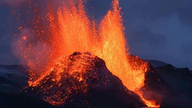
Reykjanesfólkvangur is a protected area on the Reykjanes Peninsula in Iceland, in the municipality of Grindavík. It was designated in 1975 and covers 292 km². Within it are lava formations, crater lakes, bird cliffs and geothermal fields that steam and bubble. The lake Kleifarvatn lies at its centre, with black volcanic sand along its shores. Visitors come for the viewpoints over the lake and the volcanic ground around it.
Reykjanesfólkvangur Nature Reserve
Local name: Reykjanesfólkvangur

Protected since 1975, the reserve covers 292 km² of lava formations, crater lakes, bird cliffs and geothermal ground.
- Entrance
- Free
- Parking
- Free car park at the viewpoint. Street parking is free too.
- Transport
- Self-drive (Road 42)
- Hours
- Open 24 hours, every day of the week.
What makes it special
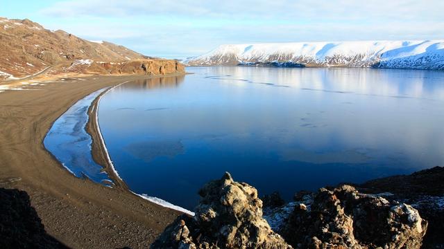
Reykjanesfólkvangur is not a single sight. It is 292 km² of the Reykjanes Peninsula, protected since 1975: lava formations, crater lakes, bird cliffs and geothermal ground that steams and bubbles. The lake Kleifarvatn sits at its centre. From the viewpoint above the lake the water reads turquoise in clear weather, with black volcanic sand along both shores and mountains on the far side. The sand and the eroded rock are what people come to photograph. In autumn the colour comes up across the lava.
Good to know
- Weather turns fast. Snow, hail, rain and sun can all arrive within two hours. Bring a windproof jacket whatever the forecast says.
- Rain takes the views away. Cloud cuts visibility over the lake, and the reserve is about looking. Keep it for a clear day.
- It gets very windy at the viewpoint, which stands above a cliff. Keep well back from the edge with a camera in your hands.
- Dogs are allowed and the reserve suits children, with the cliff edges kept in mind.
Getting there
Reykjanesfólkvangur is reached by car. There is a car park at the viewpoint over Kleifarvatn, and the view opens from the car park itself: the lake, the black sand on both shores, the mountains opposite. No walk is needed for that view. The reserve covers 292 km² of the peninsula and takes in many separate sites, not one.
Best time to visit
Better: clear, dry days, and autumn for the colour on the lava.
Avoid: rain and low cloud.
The reserve is a place for looking, and cloud takes the lake and the mountains out of the picture. In rain it empties out. Weather here can swing from snow to sunshine within a couple of hours, so a grey start does not settle the day.
Sun & daylight
Nearby Places


Similar Places


Reykjanesfólkvangur Nature Reserve on the map
The viewpoint above Kleifarvatn stands on a cliff, and the wind there is strong. Take photographs from well back — the edge is no place to step backwards for a wider frame.
Get directions
Your whole travel map in one place
Get inspired by new places around the world and find the ones worth the journey
Frequently asked questions
What is there to see in Reykjanesfólkvangur?
Lava formations, crater lakes, bird cliffs and geothermal fields that steam and bubble. The lake Kleifarvatn, with black volcanic sand along its shores, sits at the centre.Can I bring a dog?
Yes. Dogs are allowed in the reserve.Is it a good place to take children?
Yes, the reserve suits children. The viewpoint over Kleifarvatn stands above a cliff and the wind there is strong, so keep them close.How large is the reserve, and how long has it been protected?
It covers 292 km² and has been protected since 1975. It lies in the municipality of Grindavík, on the Reykjanes Peninsula.Is it worth coming in the rain?
Not really. Rain and low cloud cut the visibility, and the reserve is about long views over lava and water.