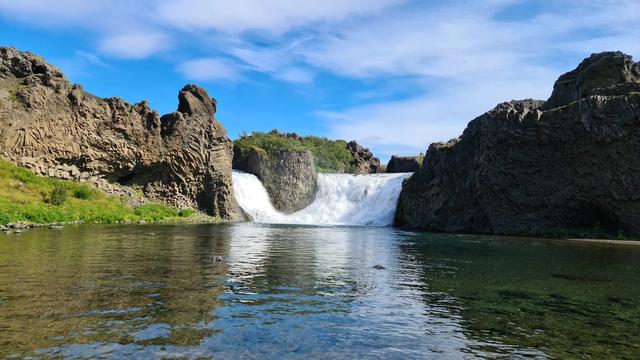
Axlafoss is a waterfall in the highlands of South Iceland, northeast of the Mýrdalsjökull glacier. It lies well away from the paved routes: the drive in crosses streams with no bridges, and from the junction the falls are a detour of just over a kilometre there and back. Google lists 36 ratings, and few people make the trip. There are no facilities of any kind — no toilets, no drinking water, no information board. Further along the same route lies Rauðibotn crater.
Axlafoss Waterfall
Local name: Axlafoss

The way in crosses unbridged streams: Axlafoss sits in the highlands northeast of Mýrdalsjökull.
- Accessibility
- Not wheelchair accessible: no accessible entrance and no accessible parking.
- Parking
- No car park at the waterfall. The nearest parking marked on maps is about 3.5 km away.
- Difficulty
- A detour of just over a kilometre there and back from the junction. The approach road crosses streams with no bridges.
- Transport
- No public transport: no bus stop within 5 km. Access is by car.
- Hours
- Open 24 hours.
- Address
- Off F210, Fjallabak highland (881)
What makes it special
Axlafoss falls in the highlands northeast of Mýrdalsjökull, well off the paved routes. Google lists 36 ratings for it, which says how little traffic it gets. The approach does the filtering: the track in crosses streams with no bridges, and one visitor came through in a small SUV. From the junction the waterfall is a detour of just over a kilometre there and back. Nothing has been built around it — no toilets, no drinking water and no information board within 5 km. Further along the same route lies Rauðibotn crater.
Good to know
- Fords on the way in: the track to the waterfall crosses streams with no bridges. One visitor got through in a small SUV.
- No facilities: no toilets, no drinking water and no information board within 5 km of the falls.
- Going on to Rauðibotn: you do not need to cross the large Hólmsá. A tributary on the right crosses easily, and the car park is just after.
Getting there
No bus serves Axlafoss, and there is no stop within 5 km, so the approach is by car. The track in crosses streams with no bridges; one visitor came through in a small SUV. From the junction the waterfall is a detour of just over a kilometre there and back. Nothing is laid out at the falls themselves — no car park and no toilets.
Sun & daylight
Nearby Places


Similar Places

Axlafoss Waterfall on the map
Reaching Axlafoss means fording streams. Do not take on the large Hólmsá: on the way to Rauðibotn there is a tributary on the right that crosses easily instead.
Get directions

Your whole travel map in one place
Get inspired by new places around the world and find the ones worth the journey
Frequently asked questions
Do you need a 4x4 to reach Axlafoss?
The track crosses streams with no bridges. One visitor drove it in a small SUV.How far off the route is the waterfall?
From the junction it is a detour of just over a kilometre there and back.Are there toilets or drinking water at Axlafoss?
No. Neither, and no information board, within 5 km. Bring what you need with you.Is Axlafoss wheelchair accessible?
No. There is no wheelchair-accessible entrance and no accessible parking.What else is on the same route?
Rauðibotn crater, further along. You do not need to cross the large Hólmsá — a tributary on the right crosses easily, and the car park is just after.