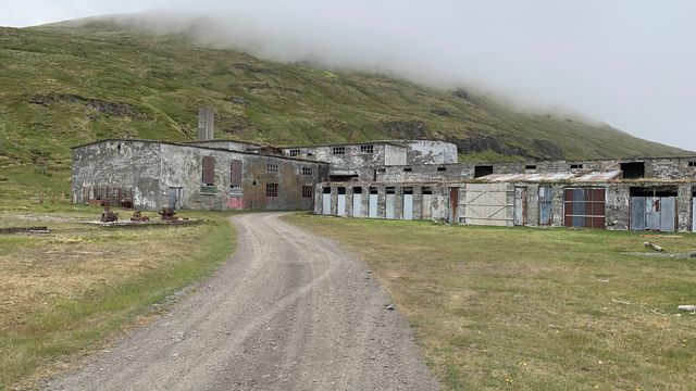
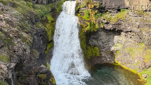
Djupavikurfoss is a waterfall in Árneshreppur, in the north of the Icelandic Westfjords. It falls down the slope above Djúpavík, a village on the Strandir coast known for its abandoned herring factory. A hiking trail runs up beside the falls to the plateau above, which gives a long view down the fjord to Gjögur. Reaching it means driving: no bus serves this part of the coast.
Djupavikurfoss Waterfall
Local name: Djúpavíkurfoss

The waterfall was used as a filming location for Justice League.
- Parking
- Two free car parks, roughly 250 m and 275 m from the falls; one gravel, the other unsurfaced.
- Difficulty
- A hiking trail climbs the slope to the right of the waterfall and continues onto the plateau above.
- Transport
- No public transport: there is no bus stop within 5 km, so access is by car.
- Address
- Djúpavík, 524, Reykjarfjörður
What makes it special
Djupavikurfoss comes down the mountainside directly above Djúpavík, so the falls, the village and the fjord sit in one view. Most of what the place offers is above the waterfall. A hiking trail climbs the slope to the right of the water and reaches the plateau, and from up there the fjord is open along its whole length, out to the point at Gjögur. The waterfall is well looked after by the people who live below it.
Good to know
- No facilities: there are no toilets and no drinking water at the falls or anywhere within 5 km.
- Cloud hides it: when cloud sits low on the mountain the waterfall disappears and the walk up gets harder.
- The trail continues: a path climbs the slope to the right of the falls onto the plateau above the fjord.
- Information board: there is one about 215 m from the waterfall.
- Djúpavík below: the village has a hotel that serves meals and the ruins of the old herring factory.
Getting there
No bus comes here — there is no stop within 5 km of the waterfall — so the approach is by car. Two unsurfaced car parks serve the falls, and the last stretch is on foot. From the bottom a hiking trail climbs the slope to the right of the water and comes out on the plateau above, with the fjord in view as far as Gjögur.
Best time to visit
Better: a clear day, when the plateau above the falls gives the full length of the fjord out to Gjögur.
Avoid: low cloud on the mountain.
Cloud can sit on the slope and hide the waterfall entirely, and it makes the climb harder going. This is a remote corner of the Westfjords and the falls are rarely busy, so timing matters for the weather rather than for the crowds.
Sun & daylight
Nearby Places


Similar Places



Your whole travel map in one place
Get inspired by new places around the world and find the ones worth the journey
Frequently asked questions
Is there a trail beyond the waterfall?
Yes. A hiking trail climbs the slope to the right of the falls and continues onto the plateau above. From there the fjord is visible along its whole length, out to the point at Gjögur.Are there toilets or drinking water?
No. There are no toilets and no drinking water at the waterfall, and none within 5 km of it. Plan for that before you set off.Why might the waterfall not be visible?
Low cloud. It settles on the mountainside and covers the falls, and it also makes the walk up the slope harder.What else is there at Djúpavík?
The village sits below the waterfall and has a hotel where you can eat, plus the old herring factory, which is the landmark of this part of the coast.