Eldfell is a volcanic cone just over 200 metres high on Heimaey, off the south coast of Iceland. It was formed by an eruption that began without warning on 23 January 1973, on the eastern edge of the town of Vestmannaeyjar. Ash and lava destroyed several hundred houses, and the whole island was evacuated. The cone can be climbed: a steep walk on loose gravel from behind the Eldheimar museum, with the town, the lava field and the sea below.
Eldfell Volcano
Local name: Eldfell

Seawater pumped onto the advancing lava — 7.3 million cubic metres of it — halted the flow about 100 metres short of the harbour mouth.
- Entrance
- Free
- Parking
- Free, near the Eldheimar museum at the foot
- Difficulty
- Steep climb on loose volcanic gravel, about an hour; the footing, not the height, is the hard part.
- Transport
- On foot from Vestmannaeyjar town (ferry to Heimaey)
- Address
- Eldfell, 900 Vestmannaeyjar, Iceland
What makes it special
The cone did not exist before 01:55 on 23 January 1973. A fissure opened on the eastern side of Heimaey, barely a kilometre from the town centre, and within two days lava fountains had piled up a cinder cone over 100 metres high. It stood 200 metres by the time the fountaining stopped on 19 February.
The eruption destroyed around 400 homes and forced out all 5,300 islanders. Most were carried to the mainland by the fishing fleet within six hours. Lava then advanced on the harbour mouth, the island's living. Crews sprayed seawater onto the flow front from February to July 1973 — 7.3 million cubic metres in all — and the flow stopped short.
Afterwards the island used what had buried it. Heat from the cooling lava supplied hot water and up to 40 megawatts of power. Tephra went into a longer airport runway and into the ground under 200 new houses.
Good to know
- Footing: the cone is steep and covered in loose volcanic gravel. Wear boots with grip; it slides underfoot, more on the way down than up.
- Wind: the summit is exposed and the weather changes fast. On a rough day the top is not worth attempting.
- No cover: the hill is bare. Grass has been planted on the lower slopes only, to hold the tephra against erosion.
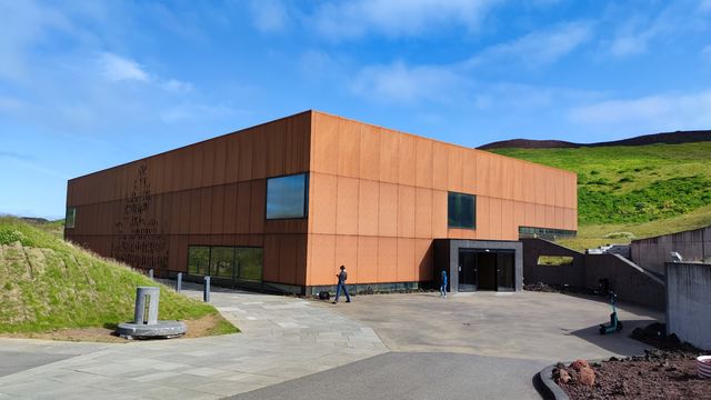
- Eldheimar: the museum at the foot of the cone covers the 1973 eruption, and the climb reads differently after it.
Getting there
Eldfell stands at the eastern edge of the town of Vestmannaeyjar, on Heimaey. The 1973 fissure opened barely a kilometre from the town centre, and the cone grew where it stood. The way up starts behind the Eldheimar museum, at the foot of the slope. From there it is all on foot: a steep climb over loose volcanic gravel to the crater rim.
Best time to visit
Better: a clear day.
Avoid: low cloud and rough weather.
The reason to climb Eldfell is the view over Heimaey and the water around it. In poor visibility there is nothing at the top but grey gravel. The weather here changes fast, so check it before starting up, not the evening before.
Sun & daylight
Nearby Places
Similar Places

Eldfell Volcano on the map
The cone is steep and its surface is loose volcanic gravel that slides underfoot; slipping is easy, and the descent is where it happens. The summit is fully exposed, and strong wind up there is normal. When the weather turns, the top is not attemptable at all — go back down.
Get directions

Your whole travel map in one place
Get inspired by new places around the world and find the ones worth the journey
Frequently asked questions
When did Eldfell erupt?
The eruption began at about 01:55 on 23 January 1973, without warning. Small tremors had been recorded beforehand, but nothing suggested an eruption. It ran for five months and ended in early July, producing about 0.25 cubic kilometres of lava and tephra.Was anyone killed?
One person. A man died of carbon dioxide poisoning after entering a cellar; the gas collected in buildings partly buried by tephra. The whole population of 5,300 was evacuated within six hours of the eruption starting.Did the lava close the harbour?
No. Seawater was pumped onto the flow front from 6 February until 10 July 1973, and the lava stopped about 100 metres short of the harbour entrance. The entrance was narrowed, but the new lava acts as a breakwater and the harbour is better sheltered than before.How high is Eldfell now?
Just over 200 metres. At the end of the eruption it stood about 220 metres above sea level and has since lost 18 to 20 metres, as the loose tephra slumped and compacted and the wind stripped it.Where does the path up start?
Behind the Eldheimar museum, at the eastern edge of the town. The climb goes straight up loose volcanic gravel to the crater rim.