Heimaklettur is a 283 m cliff above the harbour of Vestmannaeyjar, in South Iceland, and the highest point of the islands. It is climbed on stairs, a fixed rope and four ladders bolted to the rock face. The summit gives a full circle of views over the town, the harbour entrance, the sea caves and the neighbouring islands. Sheep graze up there and puffins nest around the cliff. The climb is steep and exposed, and it is not attempted in bad weather.
Heimaklettur Rock
Local name: Heimaklettur
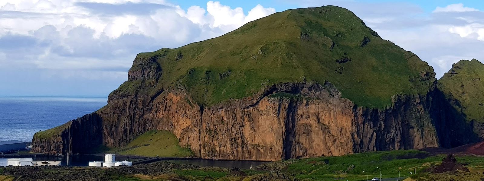
Four ladders and a fixed rope stand between the harbour and the summit, where there is a guestbook to sign.
- Accessibility
- Not accessible. The only route up runs on stairs, a fixed rope and ladders.
- Parking
- Two car parks nearby: the closer one 516 m from the rock, the second 614 m away and free of charge.
- Difficulty
- Hard. Stairs, a fixed rope and four large ladders up the cliff face, then a ridge with drops on both sides to the 283 m summit.
- Transport
- Herjólfur ferry terminal about 690 m away; the Vestmannaeyjar stop about 730 m.
- Address
- Heimaklettur, 900 Vestmannaeyjar, Iceland
What makes it special
Stairs, then a fixed rope, then four large ladders bolted to the cliff face. That is the way up Heimaklettur. Above the ladders the route runs along the mountain edge and onto a ridge with drops on both sides, up to the lookout at 283 m. The view from there is a full circle: the town, the harbour entrance with its ferries and cruise ships, the sea caves and the neighbouring islands. Sheep graze on the summit and puffins nest around the cliff. There is a guestbook at the top to sign, and the Papar Cross (Krossinn) stands on the way up.
Good to know
- Ladders and ropes. Four large ladders and a fixed rope at the start. They take one person at a time, so you wait when someone is coming down.
- Not for everyone. Anyone afraid of heights should skip it, and it is not a climb to bring children on.
- Wind decides. Do not attempt it in bad weather. Gusts on the ladders and on the ridge are the problem, not the gradient.
- Before you start. Wear proper boots and bring water. The nearest toilets are down in the town, about 630 m from the rock.
Getting there
There is no road up. Cars stop at the car parks below, and the rest is on foot. Foot passengers arriving by boat land at the Herjólfur ferry terminal and walk from there. The last stretch is the climb itself: stairs first, then a fixed rope to haul yourself up on, then four large ladders bolted to the cliff. The ladders are more unnerving on the way down than on the way up.
Best time to visit
Better: a calm, dry day, whatever the month.
Avoid: bad weather and strong wind.
Wind is the deciding factor here, not the view. The ladders and the summit ridge are exposed, and gusts turn both into a serious problem. Conditions differ between the foot and the top, and it can blow harder at the bottom than at 283 m. Puffins nest around the cliff and are present in summer.
Sun & daylight
Nearby Places


Similar Places

Heimaklettur Rock on the map
The route is exposed. Four ladders run up the cliff face, and above them the ridge has drops on both sides. Do not attempt it in bad weather: wind on the ladders is the main danger. Not a climb for children, and not one for anyone uneasy with heights.
Get directions

Your whole travel map in one place
Get inspired by new places around the world and find the ones worth the journey
Frequently asked questions
How hard is the climb up Heimaklettur?
Hard. Stairs lead to a fixed rope, then to four large ladders on the cliff face, then to a ridge with drops on both sides up to the lookout at 283 m.Can children do it?
No. The ladders and the exposed ridge make it unsuitable for children, and anyone afraid of heights should stay at the bottom.What is at the top?
A 360-degree view over the town, the harbour entrance, the sea caves and the neighbouring islands. Sheep graze on the summit, and there is a guestbook to sign.Are there toilets at the rock?
Not at the rock. The nearest are about 630 m away, and one of them is marked as accessible. No drinking water is mapped nearby, so carry your own.Can you see puffins here?
Puffins nest around the cliff and are seen in and around it in summer.