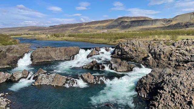
Hvítserkur is a waterfall in West Iceland, inland from Borgarnes, set in a small valley with a stream running away from it downhill. It is reached from mountain road F508, which is rough hard rock and needs a four-wheel drive, and then on foot down open ground for 10–15 minutes. There is no path, no fence and no built viewing point. People come for a waterfall they can walk right up to, without the infrastructure of the Route 1 sights.
Hvítserkur Waterfall
Local name: Hvítserkur
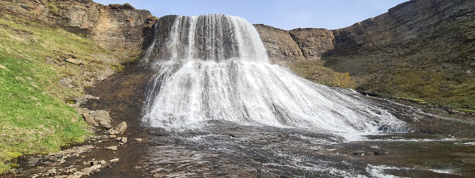
No fences, no steps, no marked path — you walk down off F508 and stand at the foot of the falls.
- Entrance
- Free
- Accessibility
- Not wheelchair accessible: no path and no made surface.
- Difficulty
- No path. A 10–15 minute walk down open ground from F508, with a couple of minor streams to cross.
- Transport
- 4x4 needed — rough mountain track
- Hours
- Open 24 hours, every day.
- Address
- 311 Fitjar, West Iceland
What makes it special
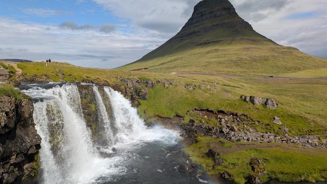
Hvítserkur sits in a small valley, with the stream from the falls running out and down through the landscape. Nothing has been built here: no fences, no railings, no steps and no marked path. You can walk right up to the water and stand at the foot of the drop.
The waterfall is visible from road F508, and the view from the road is already worth the stop. This is not one of the Route 1 sights you pull over for. The road in is rough hard rock and needs a proper four-wheel drive, and the last stretch is on foot across open ground. That filter keeps the place quiet.
Good to know
- Four-wheel drive only. F508 is rough hard rock, and it is a challenge even in a 4x4.
- Do not trust the Google Maps route. It can send you out of Borgarnes onto dirt road for the whole drive, with streams to cross.
- There is no path. You walk down over open ground from the road and cross a couple of minor streams; 10–15 minutes to the top of the hill.
- Nothing is fenced. There are no barriers at the falls and no built viewing point.
- Boots, not trainers. The ground is unmade and the stream crossings are on foot.
Getting there
The approach is by road F508, a rough hard-rock track that needs a proper four-wheel drive. The waterfall is visible from the road itself. From there you walk down over open ground — there is no path — and cross a couple of minor streams, 10–15 minutes to the top of the hill. Do not follow the Google Maps route blindly: it can take you out of Borgarnes onto dirt road for the entire distance, with streams to drive through. Check the state of F508 before you set out.
Sun & daylight
Nearby Places


Similar Places

Hvítserkur Waterfall on the map
There are no fences or barriers anywhere at Hvítserkur, and no marked path down to it. The descent from F508 is over open ground and crosses running streams. Mind your footing on wet rock and stay well back from the lip of the fall.
Get directions

Your whole travel map in one place
Get inspired by new places around the world and find the ones worth the journey
Frequently asked questions
Do you need a 4x4 to reach Hvítserkur?
Yes. F508 is a rough hard-rock road and is a challenge even in a four-wheel drive. It is not a stop to attempt in a two-wheel-drive car.Is there a path to the waterfall?
No. From the road you walk down over open ground and cross a couple of minor streams. Allow 10–15 minutes to the top of the hill. There are no steps and no fences.Can I follow Google Maps directions?
Treat the route it gives you with care. It can send you out of Borgarnes along dirt road the entire way, with streams to drive through.Is Hvítserkur wheelchair accessible?
No. The entrance is not wheelchair accessible, and the final stretch is unmade ground with stream crossings.Are there opening hours?
The site is open 24 hours. What limits a visit is the state of F508, not an opening time.