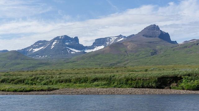
Stórurð, "the great scree", is a hollow below the Dyrfjöll mountains in East Iceland, in the hills between Njarðvík and Borgarfjörður eystri. Huge blocks of rock lie scattered across level grass around a lake. Hiking routes lead in from several trailheads, the busiest on the Njarðvík side; the round trip takes around four hours, and the steep last slope down into the hollow holds snow well into summer.
Storurd Rock Formations
Local name: Stórurð

Hollow of giant boulders and a green lake beneath the Dyrfjöll peaks, reached only on foot.
- Entrance
- Free; there is no ticket.
- Accessibility
- Not accessible for wheelchairs or anyone with limited mobility: the route climbs steep, rocky ground with river crossings and snow fields.
- Parking
- Free car parks at the trailheads, the busiest on the Njarðvík side. The nearest lies about 4.3 km in a straight line from the valley.
- Difficulty
- Mountain hike of around four hours round trip: a steep, rocky climb, river crossings, snow fields into July and a very steep final descent into the valley. Good fitness needed.
- Transport
- No bus stop near the trailheads; come by car.
- Advance booking
- No booking needed.
- Hours
- Open at all times; it is open mountain country.
What makes it special
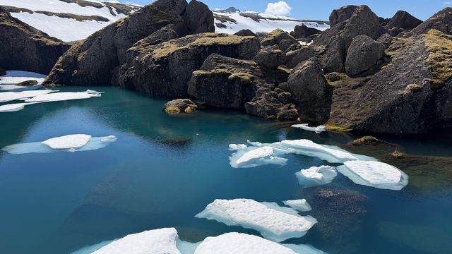
The view opens at the rim. Below lies a flat floor of grass strewn with enormous boulders, green water lying still between them, and the Dyrfjöll ridge standing over the whole hollow.
The walk in earns it. The route crosses green valleys and rivers, then climbs onto rocky ground where snow still lies in wide fields in early July, and the high point gives its own view back over the hills. Mist can sit on the tops for most of the climb and lift just as you reach the valley. Then the lake appears all at once.
It is one of the more demanding day hikes in the east of Iceland, and the reward is a valley that looks untouched.
Good to know
- Bring trekking poles and boots with real grip: snow fields cross the route in early July, and the final slope into the valley is very steep.
- Pack water and food for five hours. There are no toilets and no drinking water at the valley or near it.
- Mist can close in fast and hide the path between the marker poles; the weather swings from hot sun to cold fog.
- Wear sunglasses on the snow fields to protect your eyes from the glare.
- A circular route ends away from where it starts, so arrange a lift or a second car back to the trailhead.
Getting there
You arrive by car and walk the rest. The busiest trailhead is on the Njarðvík side, and its car park fills with the most cars; other routes start from the Vatnsskarð pass. The nearest car park sits about 4.3 km in a straight line from the valley, and the path covers more ground than that.
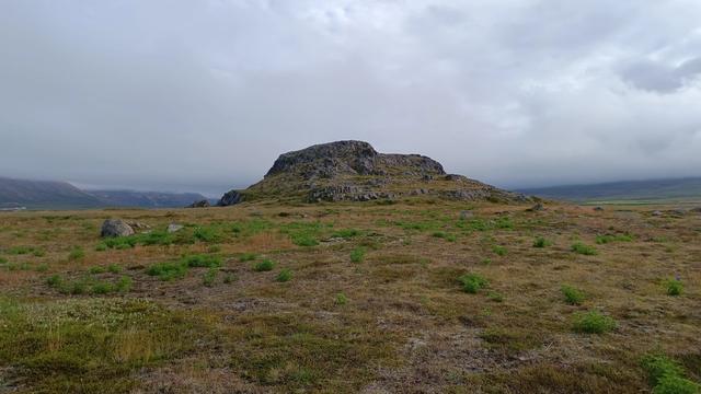
From the road the route climbs steeply over rocky ground, crosses rivers and, later, runs along steep mountainsides. The path is marked with poles. The last stretch is a very steep descent into the hollow, often under snow; take it slowly. Some walkers go in by the middle route and come out by the eastern one, which needs a lift back to the car.
Best time to visit
Best: July and August, on a clear day.
Avoid: May and late spring, and any day when cloud sits low on the Dyrfjöll.
In May the valley lies under too much snow to see, and even in early July snow fields cross the route and cover the final descent; on misty days the path is hard to follow and the view stays hidden.
Sun & daylight
Nearby Places

Similar Places


Storurd Rock Formations on the map
The final descent into the valley is very steep and holds snow into summer, and mist can hide the path on the rocky slopes. Turn back if the slope is iced or snowbound, and carry poles and warm layers.
Get directions

Your whole travel map in one place
Get inspired by new places around the world and find the ones worth the journey
Frequently asked questions
How long does the hike to Stórurð take?
Around four hours there and back. Carry enough water and food for five hours, as weather and snow can slow you down.Where does the hike to Stórurð start?
The busiest trailhead is on the Njarðvík side; other routes start from the Vatnsskarð pass. A circular walk is possible, but it ends away from your car, so arrange a lift back.Is there snow on the route in summer?
Yes. Wide snow fields still lie on the route in early July, and the steep slope into the valley stays covered. In May there is too much snow to see the valley at all.Do I need hiking experience?
Accounts range from an easy walk to a steep, technical route over rock and snow. Mountain experience is not essential, but good fitness, grippy boots and poles are.Are there toilets or drinking water?
No. There are no toilets and no drinking water at the valley or near it, so bring everything you need.