Storurd Trail Head is the Njarðvík starting point for the walk to Storurd, in East Iceland near Borgarfjörður eystri. The route climbs to a pass, and the view over the valley and out to sea widens as you go. A branch below the pass drops to a clear blue lake set among boulders. The walking routes are well marked, and the trailhead has a car park and a toilet.
Storurd Trail Head
Local name: Njarðvík (Stórurð Trail Head)
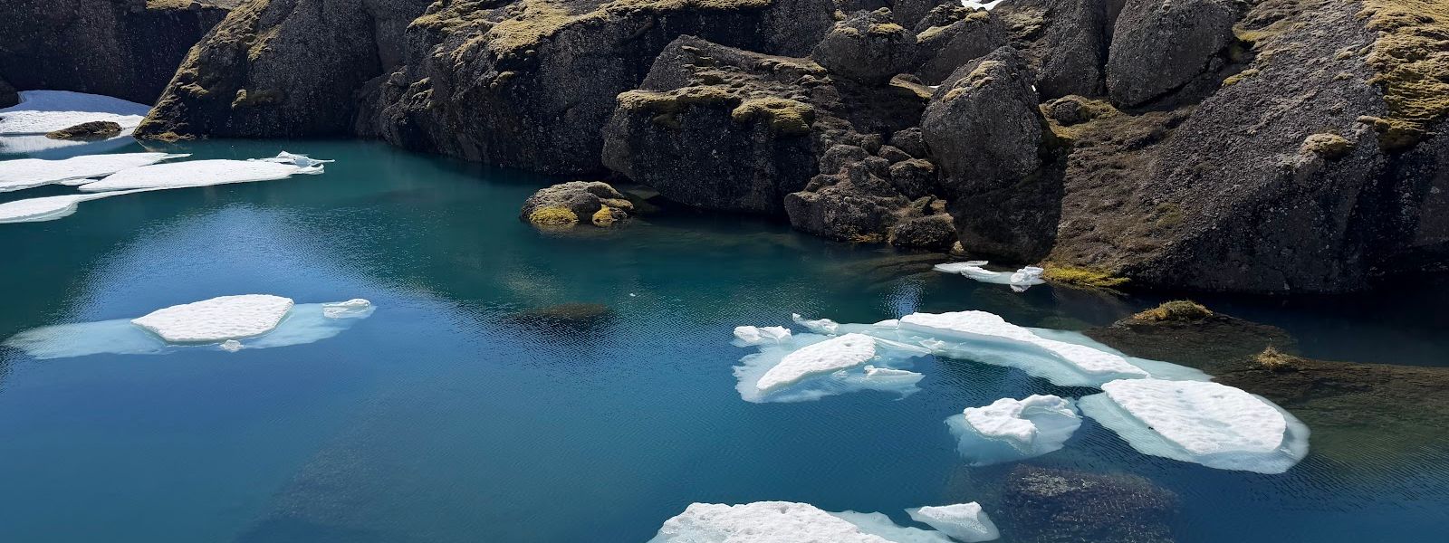
Snow can lie over the creek by the pools well into the summer, and the water underneath is about half a foot deep.
- Entrance
- Free
- Accessibility
- No wheelchair access at the trailhead.
- Parking
- Car park at the Njarðvík trailhead, where the walk starts. The smaller bays fill up.
- Difficulty
- A 12 km hike with a climb to a mountain pass, and a few creek crossings on the way.
- Transport
- Self-drive — trailhead on Road 94 at Njarðvík, near the Vatnsskarð pass
- Hours
- Open 24 hours, every day.
- Address
- Route 94, 721
What makes it special
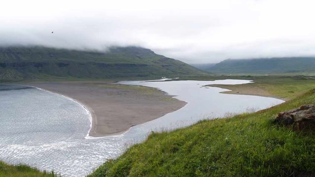
It does not take long before the valley opens below the path, with the sea behind it, and the view keeps widening all the way to the pass. Most of the work is that climb. What comes after is the reason people walk it: from the pass a branch drops to a clear blue lake set among boulders, and the path loops around the water. The boulders at Storurd are the size of houses, split apart and left standing in the grass.
Good to know
- Creek crossings: a few creeks cross the trail. After rain you will need to take your boots off at one or two of them.
- Snow: snow can still lie on the trail in late June, without being deep enough to call for crampons.
- Toilets: there is a toilet at the Njarðvík trailhead.
- Routes: the walking routes are well marked from the trailhead onwards.
Getting there
The car park at Njarðvík is the trailhead itself. The walking routes lead off from it, so the hike starts where you leave the car, with no approach path to cover first. From there the trail climbs towards the pass. The lake is a branch off the main route at the far end, added on rather than reached separately.
Best time to visit
Better: summer, after dry weather — the creeks are lower and you keep your boots on.
Avoid: the days after heavy rain, when the crossings mean wading barefoot more than once.
Snow can still lie on the path in late June, so the later part of summer gives the driest walking. The view over the valley and out to sea builds the higher you go, which makes the climb the point rather than the price.
Sun & daylight
Nearby Places


Similar Places


Storurd Trail Head on the map
The route fords a few streams that rise after rain or snowmelt, with steep sections and fast-changing mountain weather — check conditions, follow the marker sticks, and don't set out late or in poor visibility.
Get directions

Your whole travel map in one place
Get inspired by new places around the world and find the ones worth the journey
Frequently asked questions
How long does the walk take?
Allow a full day. The climb to the pass and back is the bulk of it, and the branch down to the lake adds a 2.5 km round trip.Do I need crampons?
No. Snow can still lie on the trail in late June, but not deep enough to call for crampons. Boots that cope with wet ground are more use.What is at the far end of the trail?
A pass with a view over the valley and the sea, and below it a clear blue lake among boulders, with a path that loops around the water.Is there parking and a toilet at the trailhead?
Yes to both. The car park at Njarðvík is where the walk starts, and there is a toilet there. The bays vary in size and the smaller ones fill up.