Valahnukur is a mountain peak in the Þórsmörk valley, in South Iceland. A trail runs from the valley floor to the summit: about 45 minutes up and about 30 minutes down. The top gives a 360° view over the forested valley, and in clear weather the glaciers on the surrounding mountains are visible from there. The path is rugged and steep in sections, and steps are being added to it. The area is remote, and both the mountain and the trailhead lie a little east of the map pin.
Valahnukur Peak
Local name: Valahnúkur

Forty-five minutes of climbing ends on a summit with a 360° view over the forested Þórsmörk valley and the glaciers above it.
- Parking
- Nearest car park about 1.5 km away, unpaved; a second one about 1.8 km.
- Difficulty
- About 45 minutes up, 30 minutes down. Steep in sections, slippery when wet; steps are being added.
- Transport
- Bus stops at Húsadalur, about 700 m away, and at Langidalur, about 1.5 km.
- Address
- Valahnúkur, 861
What makes it special
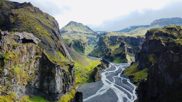
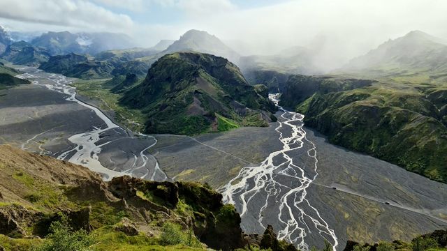
The summit gives a 360° view over Þórsmörk. Below lies the forested valley; beyond it, on a clear day, the glaciers sitting on top of the surrounding mountains. The climb takes about 45 minutes, and about 30 minutes back down. It is steep in sections and rugged underfoot, and steps are being added to the trail. This is remote country, and the mountain draws far fewer people than the roadside stops along the south coast.
Good to know
- Time on the trail: about 45 minutes to the top and about 30 minutes back down.
- Footing: steep in sections and slippery when wet and muddy. Steps are being added to the trail.
- Heights: the climb is a poor choice for anyone who suffers from vertigo.
- Map pin: the mountain and the start of the hike sit a little east of where the map shows them.
- Facilities: there are toilets at the start of the hike. Carry your own water.
Getting there
The nearest car park is unpaved and sits about 1.5 km from the mountain; a second one is about 1.8 km away. Buses stop at Húsadalur, roughly 700 m off, and at Langidalur, about 1.5 km. From the valley floor the walk to the summit takes about 45 minutes, and about 30 minutes back down. Check the map pin before you set off: the mountain and the start of the trail are a little east of where it is placed.
Best time to visit
Better: a clear day. The glaciers on the mountains around Þórsmörk are the reason for the climb, and they are only there when the cloud is high.
Avoid: wet weather. The steep sections turn slippery and muddy, and low cloud takes away the view you came up for.
Sun & daylight
Nearby Places

Similar Places


Valahnukur Peak on the map
The trail is steep in sections and slippery when wet and muddy. Anyone who suffers from vertigo should not attempt it.
Get directions

Your whole travel map in one place
Get inspired by new places around the world and find the ones worth the journey
Frequently asked questions
How long does the climb take?
About 45 minutes to the top and about 30 minutes back down.How hard is the hike?
It is steep in sections and slippery when wet and muddy, and steps are being added to the trail. Anyone with vertigo should skip it.What can you see from the top?
A 360° view over the Þórsmörk valley. In clear weather the glaciers on the surrounding mountains are visible from the summit.Are there toilets?
There are toilets at the start of the hike. Nothing on the mountain itself.Is the mountain where the map shows it?
No. The mountain and the start of the trail lie a little east of the map pin.