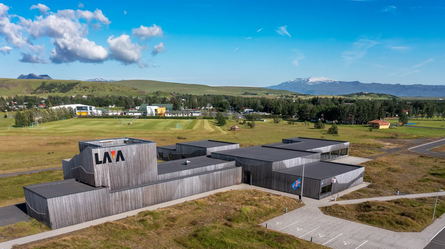
Hvolsvöllur is a town of about 1,100 people in south Iceland, 106 km east of Reykjavík. The Ring Road runs straight through it. It is one of the few Icelandic towns that stands neither on the coast nor by a river. The farmland around it is the setting of Njál's saga, and the LAVA Museum in the town covers Icelandic volcanoes and geology. Work here is mostly services and tourism; the largest single employer is the Sláturfélag Suðurlands meat plant, which makes the SS hot dog.
Hvolsvöllur

- Currency
- Icelandic króna (ISK)
- Language
- Icelandic; nearly all speak English
- Power plug
- Europlug and Schuko sockets, 230 V
- Visa
- Schengen; outside the EU
- Time zone
- UTC±00:00 (Atlantic/Reykjavik)
- Tap water
- Safe; hot water smells of sulphur
- Tipping
- Not customary
- Emergency
- 112
Things to do
All tours in Hvolsvöllur on GetYourGuide
Paid links: booking through them supports YowJourney.
When to go
Shoulder
Apr – May
Days lengthen quickly, but the air stays cool and wet. Precipitation here is abundant in every month of the year.
High season
Jun – Aug
Summers are cool rather than warm. At almost 64°N the light holds through most of the night in June, so a late drive along Route 1 is still a daylight drive.
Shoulder
Sep – Oct
Daylight falls away fast. October is normally the wettest month of the year in Hvolsvöllur.
Low season
Nov – Mar
Winters are cold, though mild for the latitude. Days are short around midwinter, which leaves few hours of light for the road east to Vík.
How long to stay
Half a day covers the town itself: the LAVA Museum, Stórólfshvolskirkja and a swim at the sports centre. Most travellers use Hvolsvöllur differently, as a base of one or two nights for driving the south coast or for catching the Westman Islands ferry from Landeyjahöfn. With 80 km of road between here and Vík, it also works as the stop that breaks a long day on the Ring Road.
Getting around
Route 1, the Ring Road, runs through the middle of Hvolsvöllur, so a car is the practical way to arrive and to move on. Reykjavík is 106 km west. Vík, the next town east, is another 80 km along the same road, and the town serves travellers and farms across a large part of southern Iceland in between.
The ferry to the Westman Islands (Vestmannaeyjar) does not sail from the town itself. It runs from Landeyjahöfn, a port built on the coast 30 km east, and you drive there.
What to see
Destinations in Hvolsvöllur
Frequently asked questions
Where is Hvolsvöllur?
In south Iceland, 106 km east of Reykjavík, on Route 1. The town belongs to the municipality of Rangárþing eystra and has about 1,100 inhabitants.How do you reach the Westman Islands from here?
By ferry from Landeyjahöfn, a port on the coast 30 km east of the town. Nothing sails from Hvolsvöllur itself, which stands inland.What is there to see in the town?
The LAVA Museum, on Iceland's volcanic and geological history. Stórólfshvolskirkja, a Protestant church of 1930 seating 120, with an altar painting of 1914 showing Jesus blessing the children. At the centre stands a 45 m telecommunications tower of 1976, strung with Christmas lights each winter since 2022.Is there a swimming pool?
Yes. The sports centre has an outdoor pool. The town has run on geothermal district heating since 1981, fed by a 95 °C borehole at Laugaland through a 23 km pipe.Is it worth stopping here on the way east?
It is the service point for travellers and the rural population over a large part of southern Iceland, and the next town east is Vík, 80 km away.