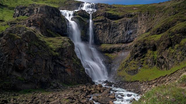
Haifoss is one of a chain of waterfalls on the river above Seyðisfjörður, in East Iceland. It is reached from a car park about 300 m away. A bridge crosses the river below the drop, and the view of the falls is better from the far side. The falls look out over the valley below. A hiking path follows the river between the falls and Seyðisfjörður, about three hours on foot. There are no toilets and no drinking water nearby.
Haifoss Waterfall
Local name: Háifoss
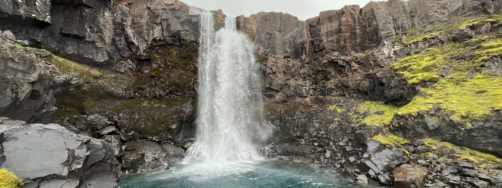
A hiking path links the falls to Seyðisfjörður through a chain of waterfalls, and it sees almost no one.
- Parking
- Free car park about 300 m from the falls; a second car park about 1.7 km away.
- Difficulty
- About 300 m on foot from the nearest car park. The full hike along the river from Seyðisfjörður takes about three hours one way.
- Transport
- Nearest bus stop: Community Centre in Seyðisfjörður, about 4.7 km from the falls.
- Hours
- Open 24 hours, every day.
- Address
- Fjarðará trail (Fossastígur), Seyðisfjörður
What makes it special
Haifoss can be two different visits. From the car park it is a quick walk in, a look at the falls and a view down the valley, then back to the car. That version is a stop, not an outing.
The other version follows the river. These falls are one link in a chain along the same water. A hiking path runs beside it all the way down to Seyðisfjörður, and the walk between village and falls takes about three hours. The trails here were built in recent years and they see very few walkers, which is unusual for a waterfall most people can drive to.
Good to know
- No facilities. There are no toilets and no drinking water at the falls or within several kilometres.
- Information board. There is an information board by the falls.
- On the map. Google Maps lists the waterfall as Múlafoss.
- Longer walk. A path follows the river between Seyðisfjörður and the falls, about three hours on foot each way.
Getting there
The falls lie up the valley from Seyðisfjörður and are reached by road. The nearest car park is about 300 m away, with a second about 1.7 km off, and the last stretch from either is on foot. A bridge crosses the river below the falls. The view of the drop is better from the far side, so cross it. The other way in is on foot from Seyðisfjörður: a path follows the river up through the chain of waterfalls and takes about three hours one way.
Sun & daylight
Nearby Places


Similar Places



Your whole travel map in one place
Get inspired by new places around the world and find the ones worth the journey
Frequently asked questions
Can you walk to the falls from Seyðisfjörður?
Yes. A path follows the river between the village and the falls, and it takes about three hours one way. It passes several waterfalls along the route.How far is it from the car park to the falls?
About 300 m from the nearest car park. A second car park lies about 1.7 km from the falls.Are there toilets or drinking water at the falls?
No. Neither is available at the falls, nor anywhere within several kilometres of them.What name does the waterfall carry on Google Maps?
Múlafoss. Search under that name if the map app does not find it.