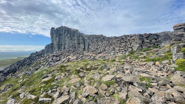
Ketubjorg is a line of sea cliffs on the Skagi peninsula in Skagafjörður, Northwest Iceland, just south of the abandoned farm Keta. The rock is the eroded remnant of an ice age volcano: columnar basalt, a large cleft and isolated pillars left standing offshore. The cliff face rises just over 120 metres above the sea. Bird life here is rich and the cliffs are a protected site. A gravel parking area and a short uphill path lead to the viewpoints.
Ketubjorg Cliffs
Local name: Ketubjörg
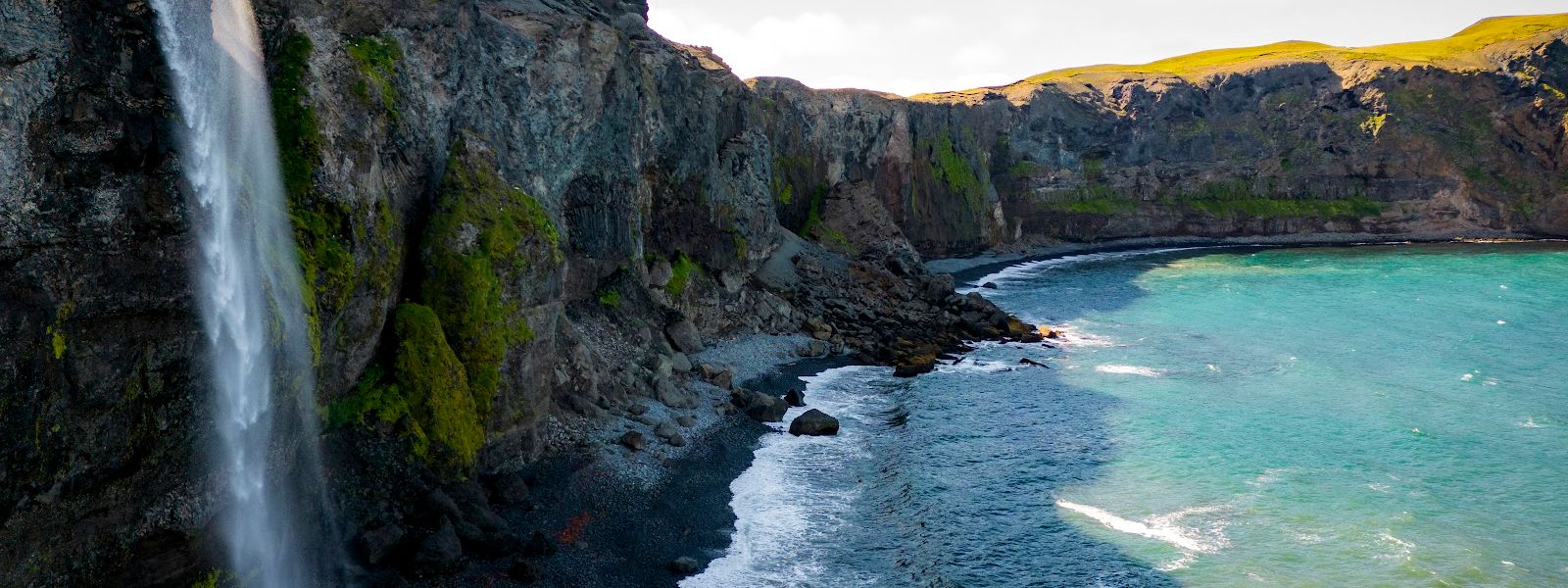
In folklore a settlement of trolls lived in these cliffs, and their parliament met in the cleft, called Tröllalögrétta — the Troll Legislature.
- Accessibility
- The entrance is not wheelchair accessible.
- Parking
- Free parking. The nearest parking area is about 400 metres from the cliffs.
- Difficulty
- Short uphill walk on a lightly used path.
- Hours
- Open 24 hours, every day.
What makes it special
The rock here is what is left of an ice age volcano. The sea cut it back into a wall of columnar basalt just over 120 metres high, split by a large cleft, with free-standing pillars left offshore. The biggest pillar is called Kerling, "the old lady". Bird life on the cliffs is rich, and the site is protected.
The national highway once ran along the edge of the cliff and had a reputation as a hard stretch of road. Folklore blamed the trolls that lived in the cleft. The farm at Keta, just to the north, is abandoned.
Good to know
- Pass the first entry point. The gravel parking area is at the second one, by the waterfall; the first turn-off leaves you nowhere to stop.
- Expect to be alone. This is a remote stretch of the Skagi peninsula, and on many days no other cars stop at the cliffs.
- A second spot sits about 1 km back towards the main road. Park at the fence line with the walking crossing and follow the stream.
- The cliffs are a protected site. Rich bird life is as much of a draw here as the rock.
- Icelandic horses graze along the road up the peninsula, sometimes right at the fence.
Getting there
Access is by car, up the Skagi peninsula and past the abandoned farm Keta. Two entry points lead off the road towards the cliffs, and the gravel parking area is at the second. From there a lightly used path climbs to the viewpoints above the cliff face. Nothing else remains of the approach: there is no shuttle and no made-up trail.
Best time to visit
Better: a clear day with sun.
Avoid: nothing in the calendar — the cliffs are not crowded at any point in the season.
Timing here is about weather rather than crowds. The drive up the peninsula is long, and the views from the path are the whole point of it.
Sun & daylight
Nearby Places


Similar Places


Ketubjorg Cliffs on the map
These are sheer, unfenced sea cliffs over 120 metres high with an unmarked path along the top — stay well back from the edge, mind the wind, and keep a close hold on children.
Get directions

Your whole travel map in one place
Get inspired by new places around the world and find the ones worth the journey
Frequently asked questions
How tall are the cliffs?
The face stands just over 120 metres above the sea. It is columnar basalt, with isolated rock pillars offshore; the largest is called Kerling, "the old lady".Where exactly is Ketubjorg?
On the Skagi peninsula in Skagafjörður, Northwest Iceland, just south of the abandoned farm Keta.Is there a walk from the car park?
Yes. A lightly used path climbs from the gravel parking area at the second entry point to the viewpoints above the cliffs.Is it busy?
No. The area is remote and lightly visited, including in June and July, and often there are no other cars at the cliffs.What is Tröllalögrétta?
The cleft in the cliffs. In folklore trolls settled at Ketubjorg and held their parliament there, until Reverend Hálfdán of Fell drove them out with sorcery.