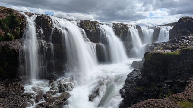
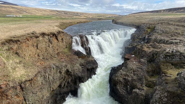
Ketubjörg Waterfall is a small waterfall on the Skagi peninsula in Northwest Iceland, where a stream runs over the top of the sea cliffs and falls to the shore below. It stands beside Route 745, the road that loops round the peninsula, and it is a roadside stop rather than a walk. A second fall lies a short way along the same cliffs. The site is unstaffed and open at any hour, and it draws far fewer cars than the waterfalls on the ring road.
Ketubjorg Waterfall
Local name: Ketubjörg
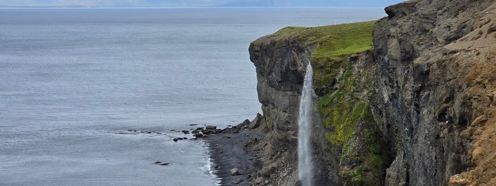
Two waterfalls go over the same line of sea cliffs, and a short walk on the cliff top links them.
- Entrance
- Free. The site is unstaffed and there is no ticket.
- Accessibility
- Not wheelchair accessible: there is no made entrance, and the cliff top is uneven ground.
- Parking
- No car park at the falls; the nearest mapped parking is about 1.4 km away.
- Difficulty
- Easy and flat. The first fall is at the roadside, and a short walk along the cliff top reaches the second.
- Transport
- No bus serves this stretch of the Skagi peninsula; the falls are reached by car.
- Hours
- Open 24 hours, every day.
- Address
- Route 745, Skagi
What makes it special
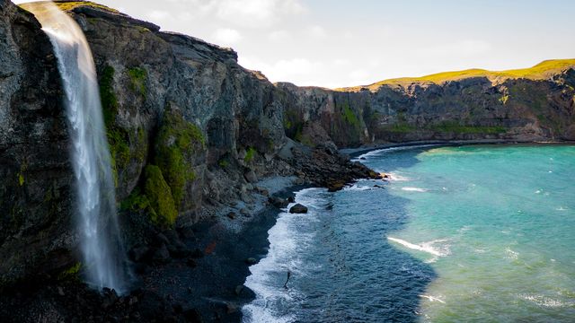
The interest here is where the water ends up. The stream crosses open ground, reaches the lip of the sea cliffs and drops to the shore, so the fall and the coastline sit in the same view. There are two falls rather than one, and the second is a short walk from the first along the same cliffs. Ketubjörg is the name of the cliffs themselves, and the waterfall takes it from them. Nothing here takes long — the stop is a break in the drive round the peninsula rather than a destination in itself.
Good to know
- No facilities: there are no toilets, no café and nothing staffed at the falls; the nearest services are back along the peninsula road.
- Two falls: a short walk over open ground links the first waterfall to the second, with no steps and no handrail.
- Underfoot: the ground beside the stream is wet, and grass at the cliff top gives little grip in the rain.
- Quiet stop: the site draws few cars, and you will often have the cliff top to yourself.
Getting there
Ketubjörg Waterfall sits beside Route 745, the road that loops round the Skagi peninsula, and the last leg is driven rather than walked. No car park is mapped at the falls themselves, and the nearest one lies about 1.4 km away. Once you have stopped, the first fall is at the cliff edge; the second is a short walk along the same stretch of coast.
Best time to visit
Better: late May to August, when daylight on this coast lasts most of the night and seabirds are on the cliff ledges.
Avoid: midwinter, when only a few hours of daylight fall on a stop that is entirely about the view.
The site stays quiet whatever the season, so timing here is a question of light rather than crowds.
Sun & daylight
Nearby Places

Similar Places

Ketubjorg Waterfall on the map
The stream goes over an unfenced cliff top, and the drop below is straight down to the shore. The wind on this coast arrives in gusts strong enough to push you off balance, so keep well back from the lip.
Get directions

Your whole travel map in one place
Get inspired by new places around the world and find the ones worth the journey
Frequently asked questions
How many waterfalls are there at Ketubjörg Waterfall?
Two. The stream forms a second fall a short walk from the first, along the same line of sea cliffs.Is there any walking involved?
Only a short walk. The first fall is at the roadside, and the second lies a short way along the cliff top over open ground.Is the stop suitable for young children?
The falls run off an unfenced cliff top with a straight drop to the shore, so children need holding close.What are the cliffs at the waterfall?
Ketubjörg, a line of sea cliffs on the Skagi peninsula. The waterfall is named after them and falls from their edge.