Santa Úrsula stands 290 metres up on the north coast of Tenerife, 6 km east of Puerto de la Cruz and 24 km west of Santa Cruz de Tenerife. The municipality covers 22.59 km² and is home to around 15,400 people. The town is named after Saint Ursula. The TF-5 motorway, the main road along the north of the island, runs straight through it, which puts both of the north's larger towns within a short drive.
Santa Úrsula
- Currency
- Euro (EUR, €). ATM withdrawals often incur charges of €1–8; bringing some cash (€50–100) can help avoid fees. Credit and debit cards are widely accepted in cities and tourist areas. Bizum (a Spanish payment app) is popular with locals and some businesses but requires a Spanish bank account. The islands are outside the EU's standard VAT area.
- Language
- Spanish (specifically Canarian Spanish dialect) is the native language. English is widely spoken in hotels, restaurants and tourist attractions, but understanding outside these areas is very limited. In smaller towns and rural areas, English proficiency is minimal. Hotel and restaurant staff generally know basic English.
- Power plug
- Europlug (Type C) and Schuko (Type F) sockets; 230 V, 50 Hz
- Visa
- Schengen area: EU, EEA and Swiss nationals enter on national ID card or passport. Many non-EU nationalities have 90-day visa-free access. Non-EEA citizens staying longer than 90 days require an advance visa.
- Time zone
- Atlantic/Canary (UTC±00:00 in winter, UTC+01:00 in summer); one hour behind mainland Spain.
- Tap water
- Safe to drink throughout Spain. In some southern regions it has high mineral content and may taste unfamiliar; locals often drink bottled water instead. Bottled water is inexpensive and widely available.
- Tipping
- Not mandatory or customary. In restaurants: not expected for simple meals or basic establishments; 5–10% in mid-range or upscale venues if service was exceptional. Always pay cash to the server, not on card. Taxi drivers and hotel staff may appreciate small tips in upscale settings but it is not expected.
- Emergency
- 112
When to go
High season
Nov – Mar
Winter-sun visitors fill Tenerife, while the north coast takes most of the island's rain and its slopes turn their greenest.
Shoulder
Apr – Jun
The rain eases and the island is quieter, though trade-wind cloud often settles over the northern slopes during the day.
High season
Jul – Aug
Spanish summer holidays bring the island's second peak, and the north coast stays milder than the south under its cloud.
Shoulder
Sep – Oct
The summer crowds leave and the north coast holds its warmth before the winter rain arrives.
How long to stay
Treat Santa Úrsula as a stop of a few hours on a drive along the north coast. A longer stay makes sense only as a base: Puerto de la Cruz is 6 km away and Santa Cruz de Tenerife 24 km, and the TF-5 runs through the municipality, so two or three days here can cover much of the north side of the island.
Getting around
The TF-5 motorway crosses the municipality and carries the traffic along the north coast. Puerto de la Cruz lies 6 km to the west and Santa Cruz de Tenerife 24 km to the east, both reached by that road. The town sits at 290 m, well above the sea, so on foot every trip down towards the coast ends with a climb back up.
What to see

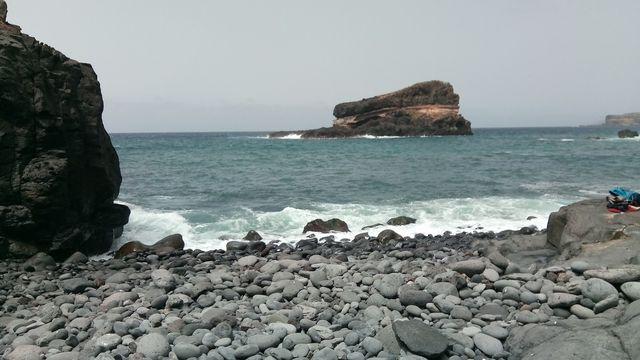
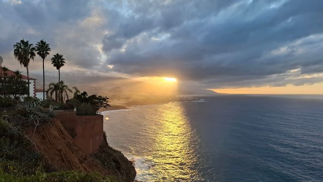
Destinations in Santa Úrsula
Frequently asked questions
Where exactly is Santa Úrsula?
On the north coast of Tenerife, 6 km east of Puerto de la Cruz and 24 km west of Santa Cruz de Tenerife. The town stands at 290 m above sea level.Which road goes through Santa Úrsula?
The TF-5 motorway, the main road along the north of Tenerife, passes through the municipality.How big is Santa Úrsula?
The municipality covers 22.59 km² and has around 15,400 residents.Where does the name come from?
The town is named after Saint Ursula.